In this post:
- Route of the Dartmoor-Traverse
- Trip report: Crossing Dartmoor in 6 days
- How to get to Dartmoor
- Accomodation
- About hiking in Dartmoor
- Wildcamping
- Equipment needed
- Climate and best time to travel
- My verdict
Dartmoor is one of the most fascinating landscapes in Central Europe: A vast high moor covering nearly 1,000 square kilometers, sparsely populated and crossed by only a few roads. A windswept, rain-soaked no-man’s-land, scattered with bizarre granite tors and mysterious Bronze Age stone circles. A white patch of wilderness in England’s densely populated southwest.
Crossing this landscape on foot had long been a dream of mine. As a child, I devoured the most famous of all Sherlock Holmes stories, The Hound of the Baskervilles: the brilliant detective tracking a mysterious hellhound in the depths of Dartmoor. That story has always fueled my imagination. I had always wanted to see the setting with my own eyes.
But it`s a long time since I last set foot in merry old England. For years I trekked through the Himalayas and the Andes, admired the highest peaks of the Caucasus and explored remote mountain valleys in the Alps. And this despite holding a degree in English literature and having a sister who lives near London for over 15 years and is married to an Englishman. Dartmoor had always lingered in the background but never quite made it to the top of my list.
Until the summer of 2024.
Crossing Dartmoor solo: The idea
This story started with an invitation from my sister to join the English family for a holiday in Cornwall. After being away from England for so long, I couldn’t say no this time. Wandering the mountains of the world with a backpack every year is all well and good but I also wanted to spend some quality time with my family and see more of my nephews than just the occasional WhatsApp photo.
And then it hit me: Wait a minute, Cornwall is in the far southwest of England, right next to Devon. And in Devon you have… exactly, Dartmoor! Wouldn`t it be possible…?
It was at this point that I dug out my old plans. My trusty OS Explorer Map of Dartmoor has been gathering dust in my cupboard for years. At one time I had even mapped out a few possible routes and once pieced together a theoretical route.
My rough idea: To hike from south to north across the entire Dartmoor, taking in as many highlights and famous landmarks as possible. With a tent of course, that would be the only way. Dartmoor is wilderness. There are no mountain huts for overnight stays and apart from a few tiny villages and some roads cutting through there’s no real civilization.
The next few weeks I spent planning the trip. I pored over maps, studied hiking guides and spent countless hours on Google Maps. Eventually I had my final route. August drew closer, I flew to England and spent a wonderful week in Rosamunde Pilcher country. Then I boarded the train to Devon.
The Dartmoor adventure was about to begin.
At a Glance
- Full traverse of the legendary Dartmoor from south to north
- Distance: approx. 100 kilometers
- Difficulty: moderate
- Adventure rating: high
- Few marked trails, often narrow footpaths, some sections pathless
- Good rain protection recommended, but still expect to get wet—especially your feet
- Full camping gear, including a tent and provisions required
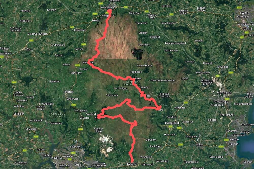
Route of the Dartmoor Traverse
Before diving into the trip report, a quick overview of my route. At first, I considered following one of the official hiking trails. Dartmoor has two well-known long-distance routes:
- Two Moors Way
- Dartmoor Way
Both are multi-day hikes, which is great in theory. But they have one major drawback: They only touch the edges of Dartmoor. The reason is simple—these routes are designed for hikers who want to stay in fixed accommodations each night and those simply don’t exist in the heart of Dartmoor.
But that’s exactly what I wanted to see: The inner parts of Dartmoor, the true wilderness. So I had to create my own route. A huge help was the already mentioned OS Explorer Map. I also planned parts of the route using the app Outdooractive while some sections followed barely visible paths that aren’t recorded anywhere else. I found them with Google Maps.
Map of the Dartmoor Traverse:
Download the GPS-track for the Dartmoor Traverse:

The Hike
The trek begins in the small town of Ivybridge at the southern edge of Dartmoor. From there, I follow the course of the River Erme, passing the longest prehistoric stone row in the world before ascending to the southern plateau of the moor. From the ruins of the old china clay quarry at the remote Red Lake I take an ancient monk’s path, crossing the high moor until I reach Burrator Reservoir, an artificial lake in the southwestern part of the moor.
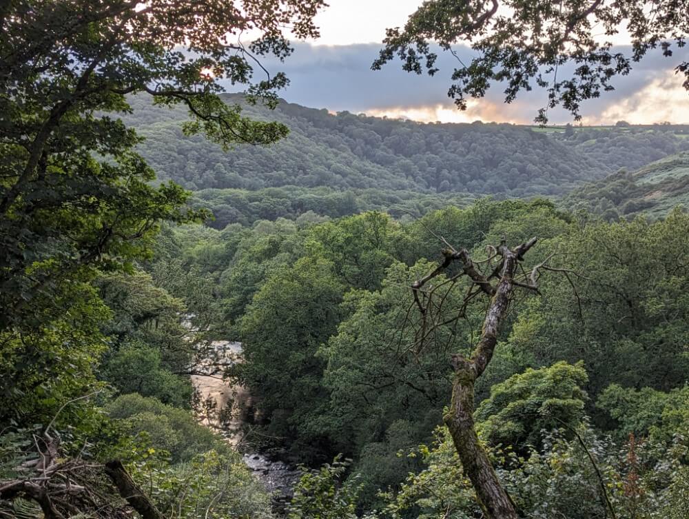
From here I push into the heart of Dartmoor, passing the infamous Fox Tor Mires—one of the inspirations for The Hound of the Baskervilles—and hike towards the gorge-like valley of the River Dart. Following an adventurous trail through one of the few remaining temperate rainforests in Europe, I eventually reach the tiny hamlet of Dartmeet where I begin the climb onto the northern plateau of Dartmoor.
The final stretch leads through the most remote part of Dartmoor, an area also used by the British Army as a training ground. I follow the old “corpse road”, visit the mystical Wistman’s Wood—one of Dartmoor’s three highland forests—and finally reach the dramatic Tavy Gorge, following an exciting path toward the highest peaks of the region. At High Willhays Tor (621 m), the highest mountain in southern England, the end is already in sight: the town of Okehampton on the northern edge of the moor. Here the journey concludes.
Map and Hiking Guide
My recommendation: Wild Guide Devon, Cornwall and the South-West
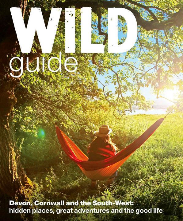
The Wild Guide series is one of the best travel guides for nature lovers traveling to the UK. All the books are thoroughly researched and include genuine insider tips from locals – this is also true for this outdoor guide to South West England*.
The book contains several detailed chapters about Dartmoor, including well-known as well as many lesser-known attractions. When planning my route through Dartmoor, I mostly relied on this book.
Together with a good hiking map*, this book will prepare you for any situation!
A hiking map is essential for Dartmoor. Firstly, because it marks impassable bog areas. Secondly, because there are few marked trails. Thirdly, because many of the locations in the Wild Guide are so obscure that you’ll hardly find any information on how to get to them. The best option is the OS Explorer Map Dartmoor OL 28 (scale 1:25,000), which covers the entire moor.
A digital alternative is an app like Outdooractive. It’s important that the maps reliably depict the topography so you can identify potentially dangerous bog areas. A basic OpenStreetMap layer isn’t quite detailed enough for that. The Pro version of Outdooractive includes the OS Explorer Map mentioned above.
For day hikes, the Walking Guide Dartmoor from Cicerone is a great choice, featuring 40 routes.
Duration of the Hike
I originally planned five days for the Dartmoor traverse but in the end it took six. The terrain was more challenging than expected in some places. Some sections were pathless or nearly pathless and I had to take a few unplanned detours. For example, I had to abandon my plan to cross the infamous Fox Tor Mire—the marked path on the OS map simply didn’t exist and I wasn’t willing to risk sinking into a bog.
Other than that I was able to complete the hike almost exactly as planned. As always, my goal wasn’t to move as fast or efficiently as possible but to hike the most scenic and interesting route—and I think I succeeded in that. The hike was incredibly varied which isn’t always easy in Dartmoor. The actual moor looks fairly similar in many places.
To start with, here is the trip report from my 6-day-hike, based on the diary entries and photos I took on the journey. Below, you´ll find plenty of practical advice on how to plan that kind of hike in Dartmoor.
Trip report: Hiking through Dartmoor in 6 days
Monday, August 19, 10:00 am. I`m standing at the train station in Ivybridge, deep in the English countryside. This morning, I traveled from Cornwall via Plymouth on the Great Western Railway. The weather forecast is mediocre, the sky covered in thick gray clouds. The air smells of rain. However, I`m not concerned at all. This is the perfect atmosphere to set off across one of England’s largest wilderness areas.
Ascending the southern plateau
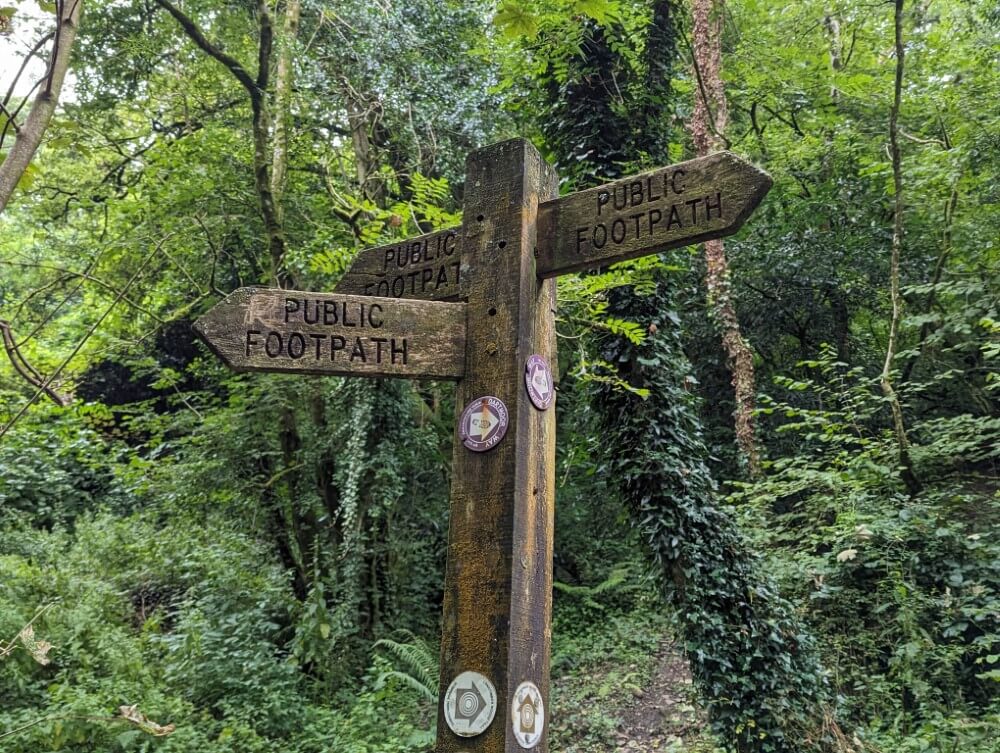
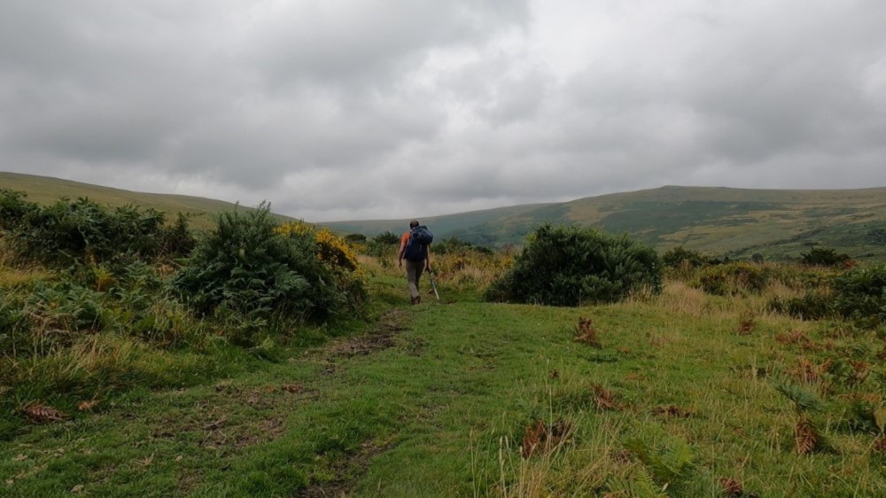
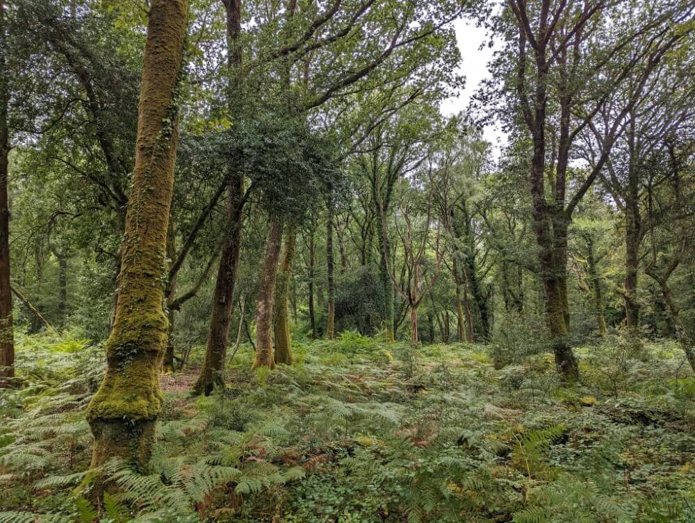
The streets of Ivybridge are deserted, no one is outside. The town feels completely abandoned. I quickly leave the gray slate houses behind me and follow a weathered wooden signpost, which leads me onto an old footpath into Longtimber Wood north of the town. From here, I plan to ascend to the southern plateau of Dartmoor.
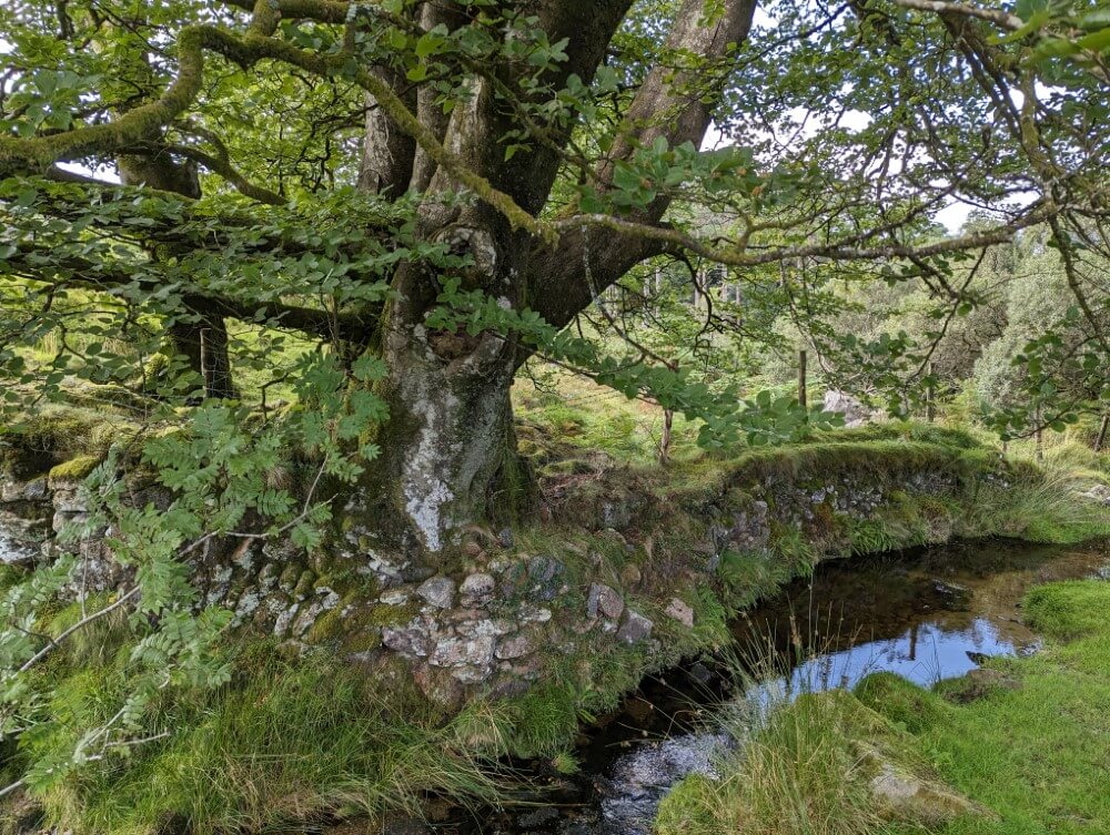
I walk in the dim light beneath the dense green canopy of the forest following the gently babbling River Erme. In the riverbed massive moss-covered boulders lie scattered while the gnarled trees are draped in lush green ivy and thick cushions of moss. The atmosphere is magical—there’s something truly special about these English woodlands.

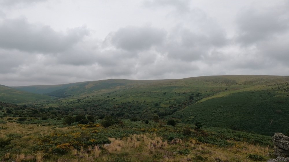
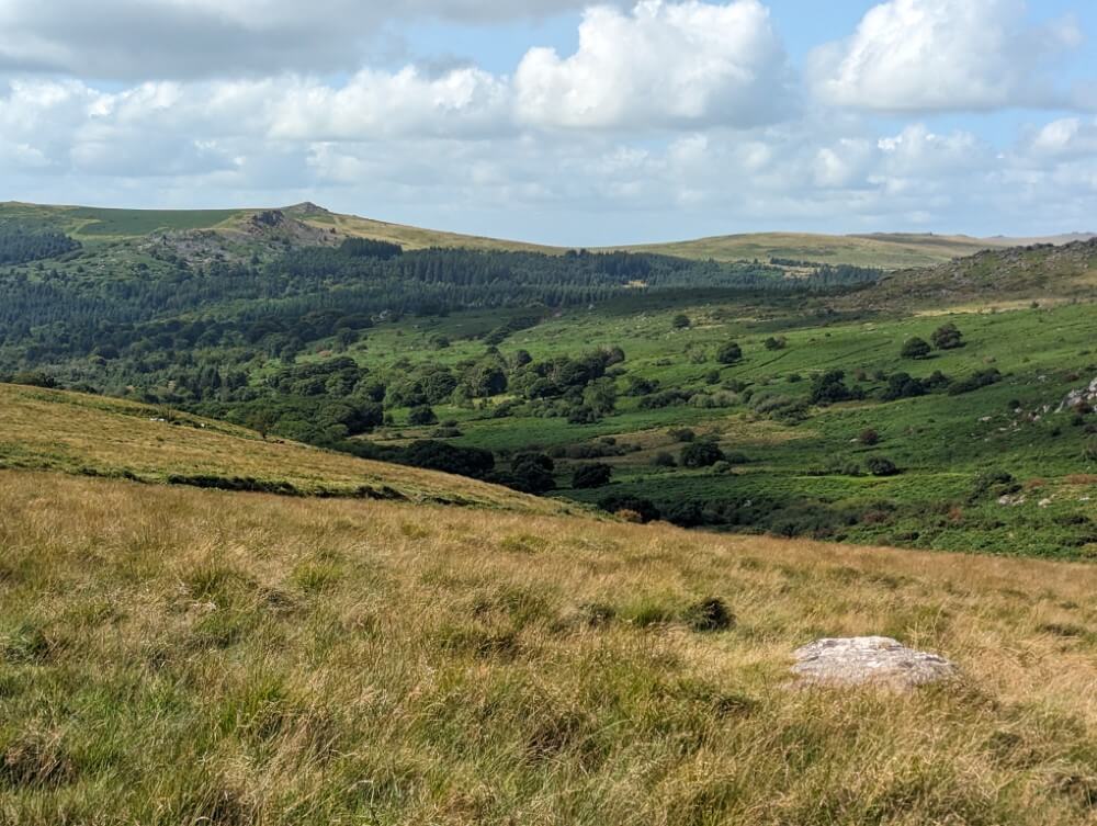
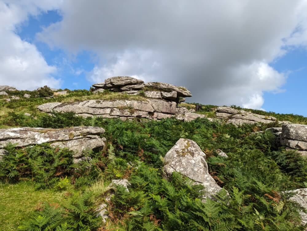
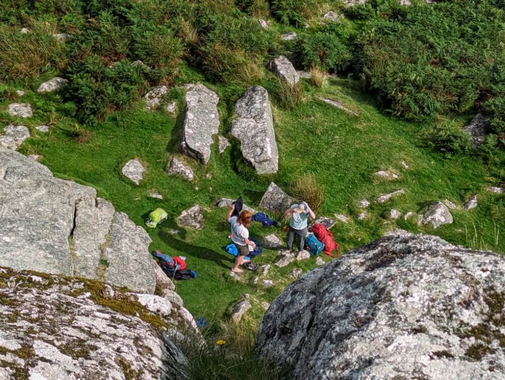
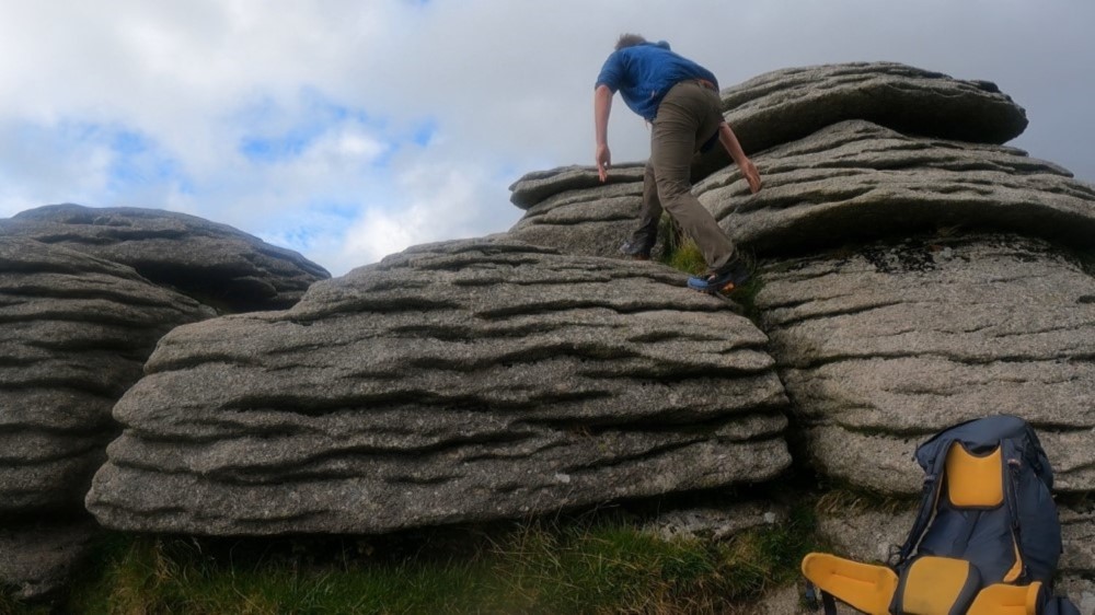
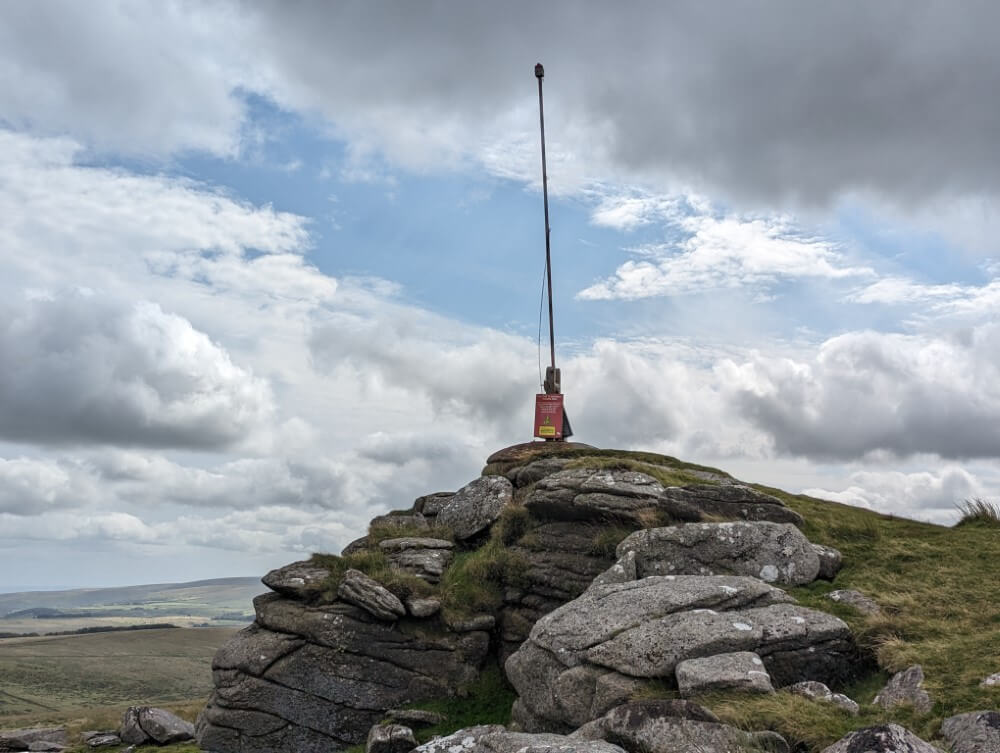
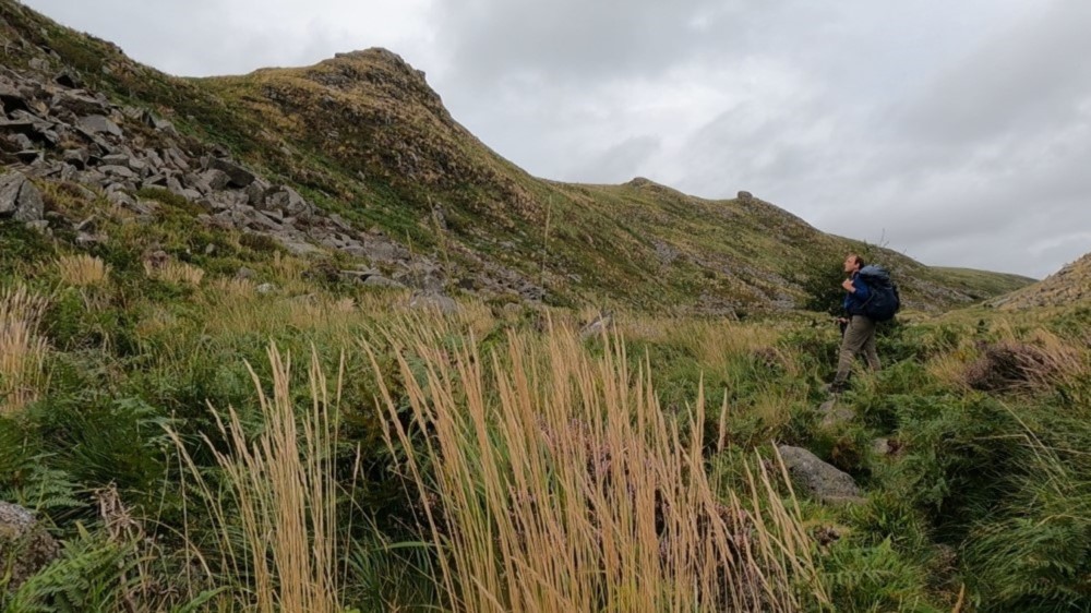
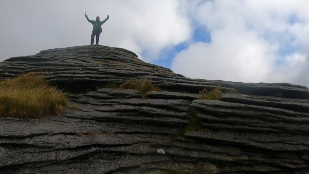
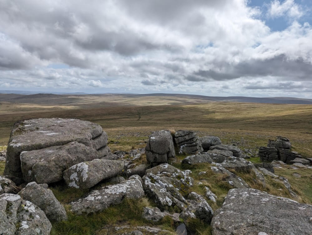
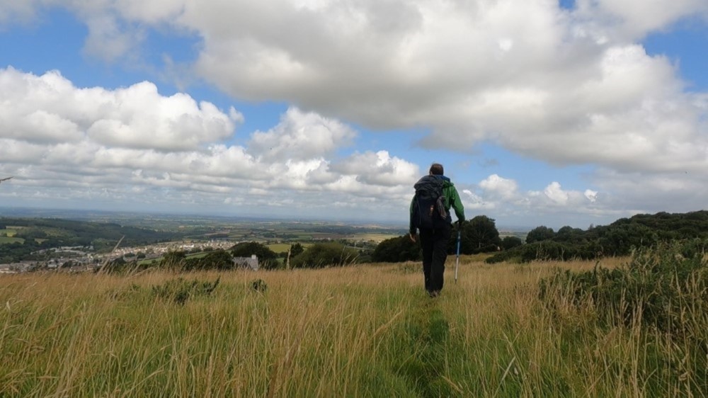
Just under an hour later the forest fades behind me as the path winds through fields of towering ferns. I´m astonished at how large these plants are—but the reason is quite obvious: There’s no shortage of rain here. Finally at Burford Down I reach my first “tor.” In Dartmoor this is the name for the large hilltops crowned with granite rocks that rise from the landscape everywhere.
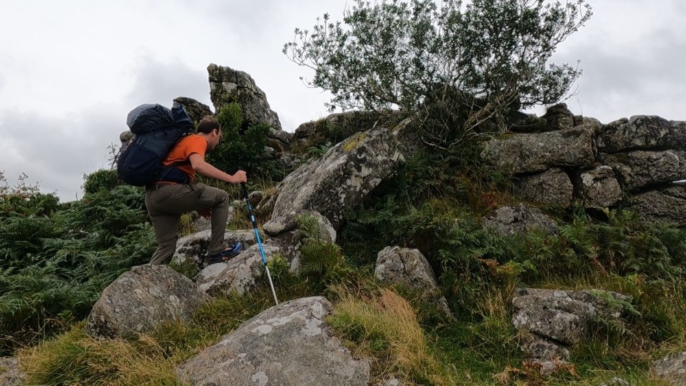
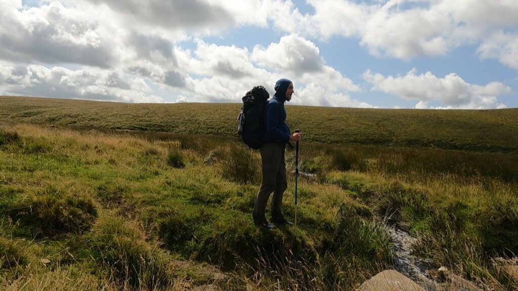
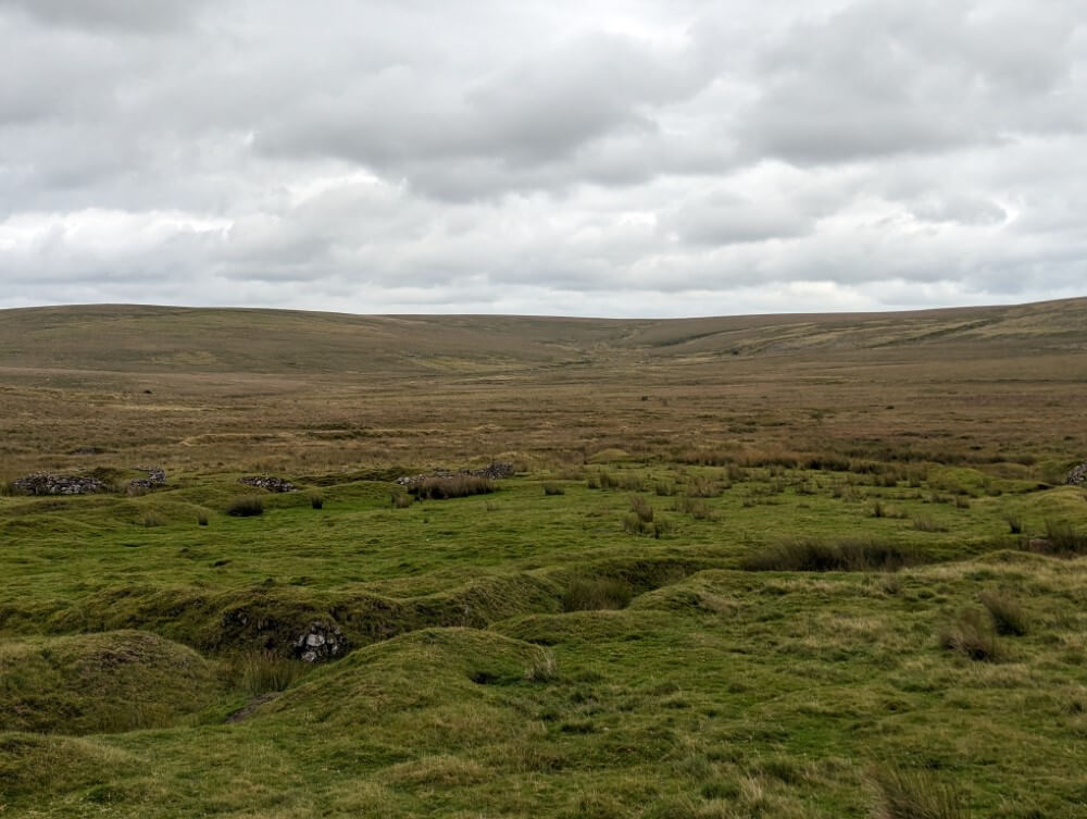
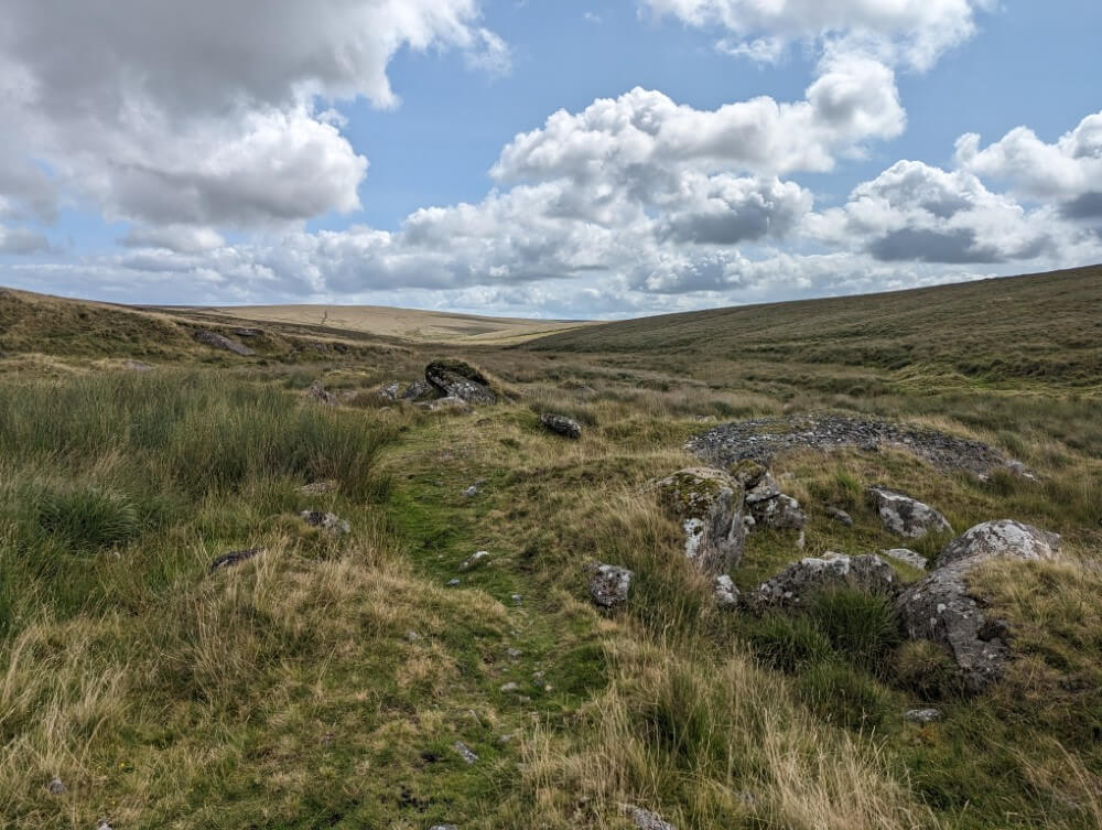
Even though a few raindrops begin to fall and the wind picks up, of course I don’t miss the chance to climb the tor. At the top, the wind is so strong that I nearly get blown away. But the view is worth it: I get my first clear sight of the southern plateau of Dartmoor. Before me stretches an almost endless ochre-colored grassland, interrupted only occasionally by low hills and long, winding valleys. It’s not spectacular in the normal sense of the word, but the sheer scale impresses. The vastness brings to mind Central Asia, this is not something you’re used to in Europe.
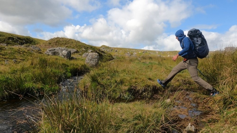
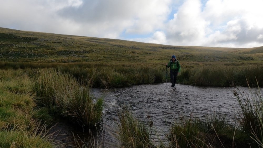
On a barely discernible footpath I descend toward the upper reaches of the River Erme and find myself in the first real Dartmoor swamp of my journey. These vast wetlands particularly form in the river valleys where the rainwater gathers most effectively. They consist of countless small ponds, puddles and a kind of damp grassy carpet that initially seems completely harmless. But as I take a step onto it, I sink up to my ankle in the water with my trail runners. Oh well… I already figured my feet would get wet sooner or later.
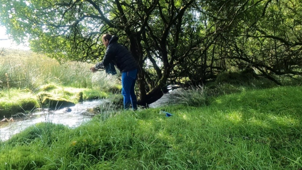
I follow the River Erme for a while until I reach Piles Copse, a beautiful little oak woodland right by the river. The river babbles merrily over a wide weir. The large, surprisingly dry meadow would make a perfect camping spot. But it’s still too early and if I’m lucky I have about two hours before the real rain starts.
So I leave this idyllic spot behind and climb the gently sloping hills covered with heather towards the moor. Interestingly, it remains marshy even as I leave the river valley behind. Apparently elevation doesn’t make that much of a difference. Even at higher altitudes I find myself sinking into the damp grass again and again.
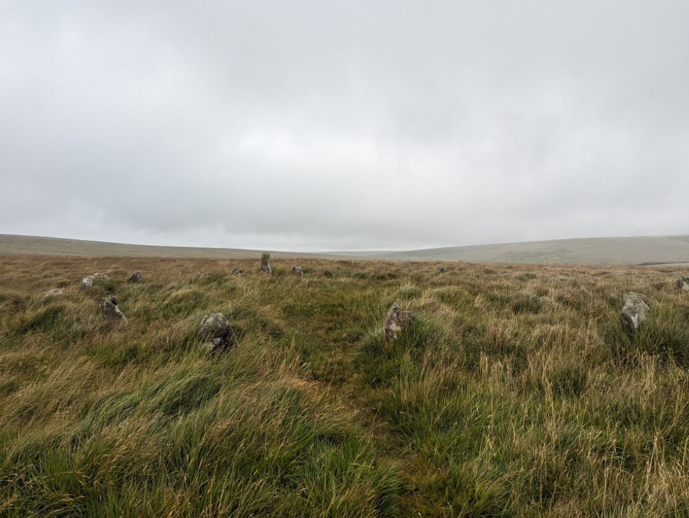
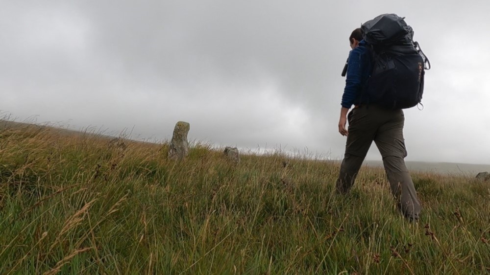
In increasingly gloomy weather I cut across the fields toward a large hilltop where several boulders are arranged in a large stone circle. This must be the “Kiss in the Ring Circle”—one of the many stone circles in Dartmoor. Who built these stone circles and more importantly: Why? That is lost in the mists of history. Little is known about prehistoric man who lived here. But it doesn’t take much imagination to picture the druids gathering for mysterious rituals here on full moon nights.
The longest stone row in the world is in Dartmoor
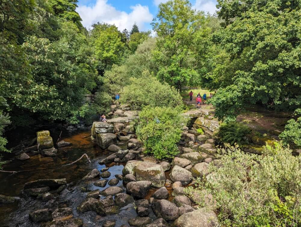
By now it has started to rain. The drops aren’t heavy, more of a fine, penetrating “drizzle”, as the English call it. But you still get wet so I make sure to keep moving. Beyond the stone circle, more stones rise on either side of a barely discernible footpath: the “Staldon Stone Row”—a stone row over 3.5 kilometers long, making it the longest artificial stone row in the world. Who would have thought that the English countryside hides such secrets? Certainly not me…
I follow the stone row, which stretches far ahead of me to the north, disappearing into the low cloud-covered hills. Mist swirls around the stones— an otherwordly sight. Sometimes, it almost looks like a procession of people walking in a long line across the wind-swept moor. But let’s be honest: in this weather I’m the only one out here. Visibility gets worse with each passing moment. Since I’ve put together a GPS track, I somehow manage to stay on course.
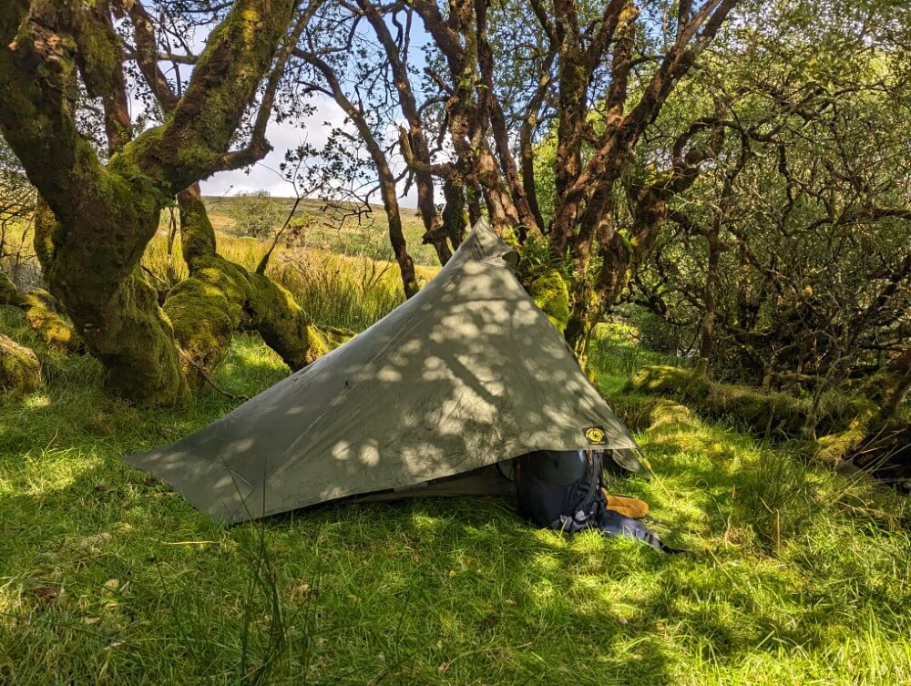
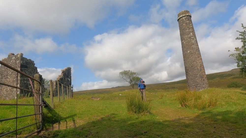
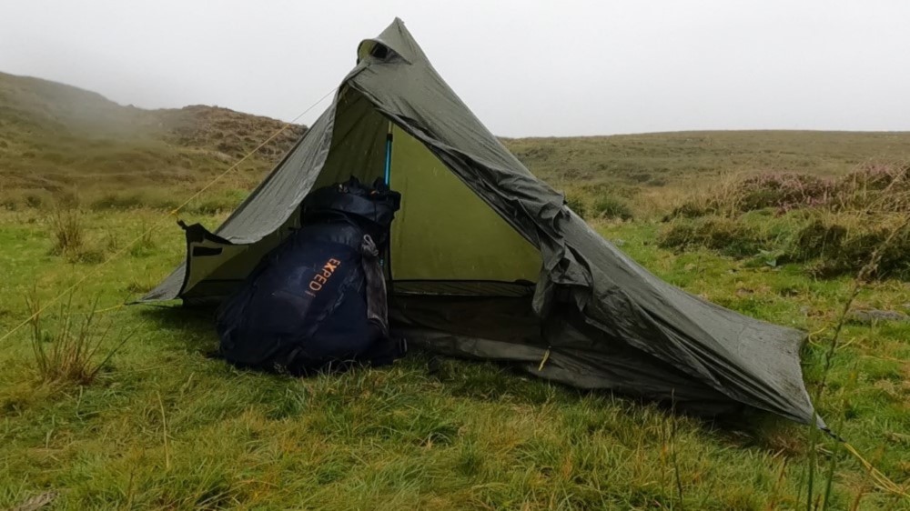
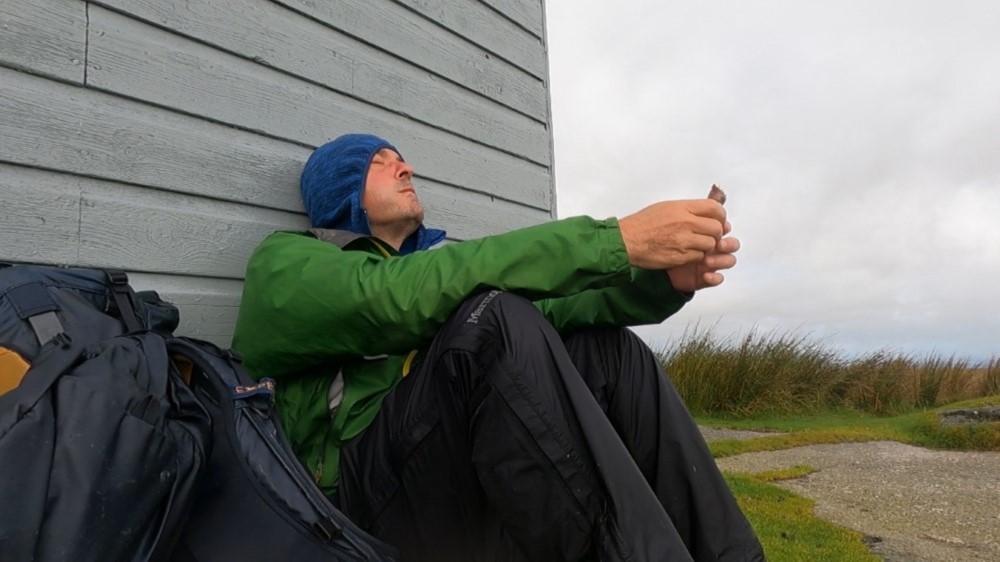
After what feels like an eternity, I finally reach a wider track again. It’s completely muddy, but still pleasant enough to walk on. A short while later I arrive at my planned camp at Red Lake, a small lake in the middle of the vast moorland. There used to be a clay quarry here. The track I’ve been walking on is the old railway route that they used to transport the clay out of the moor. When I reach the lake, the rain really starts hammering down. Strong winds lash the raindrops furiously into my face. I set up my tent as quickly as possible, praying that I’ll spend at least a somewhat dry night.
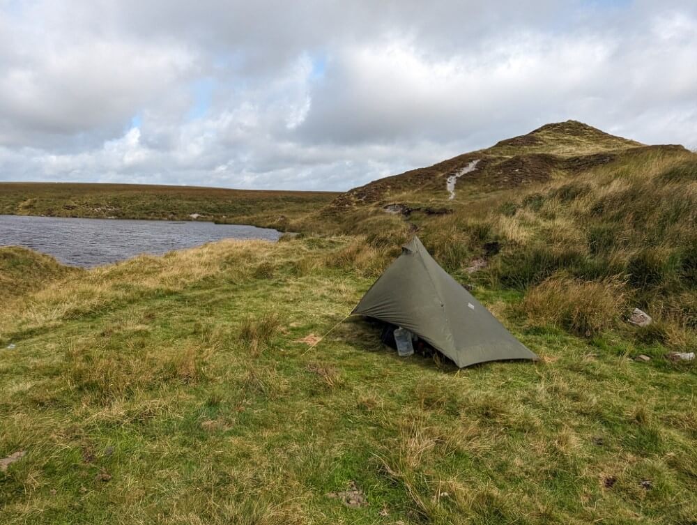
The next morning, I don’t set off until around 10 a.m. when the rain finally ceases. Despite everything, the night was somewhat comfortable. Occasionally it did rain under the fly into the tent but my modest Lunar Solo handled the storm quite well. Shortly after, the sky begins to clear and I can see Red Lake properly for the first time. It’s an artificial lake with the former quarry now filled to the brim with water. The clouds are mirrored in the steel-gray surface, gusts of wind ripple the water into small waves. It’s a beautiful place!
Bog hopping for beginners
Finally, I set off. My route takes me along a section of the “Abbot’s Way.” This is now one of the official hiking trails in Dartmoor connecting the two monasteries of Buckfast and Tavistock on the edge of the southern moor. Its origins date back to the Middle Ages. At that time there were many small monasteries and abbeys around Dartmoor. When the monks wanted to visit each other they had to either take long detours or cross the moor directly—via the Abbot’s Way.
I quickly realize that the Abbot’s Way is more of an idea, not a proper path. Most of the time it’s just a strip that leads through the moor on the driest spots. Although that’s is very relative in Dartmoor. I’m now quite high, over 400 meters, but that doesn’t automatically mean it’s drier here. “Blanket Bog” is what these elevated wetlands are called—peat carpets—and that’s quite fitting. It constantly gurgles and bubbles beneath me as I stomp through the damp grass with squeaky steps. At times, the soft carpet of grass almost reminds me of a natural trampoline.
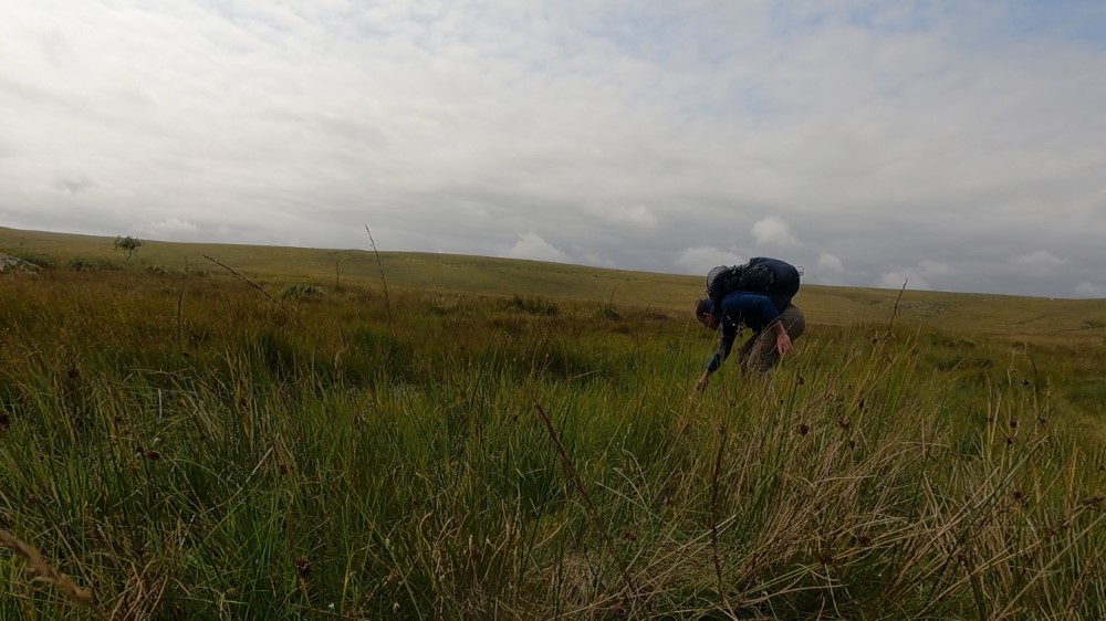
When I try to cross a stream, I first have to make a few daring jumps—not so easy with my large backpack. But in the process, I also quickly learn one of the most important skills that any hiker in Dartmoor should have: “bog hopping.” You hop from clump of grass to clump of grass, trying not to step into one of the puddles. The clumps of grass are usually a bit more solid than the ground underneath and relatively safe. Of course, you can`t walk in a straight line so even short distances of “bog hopping” might take up quite a bit of time.
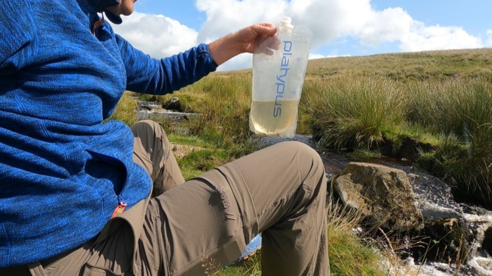
I reach a beautiful little valley between green hills covered with granite boulders and stop to filter drinking water from a stream. The stream here has a decent flow, cheerfully jumping over the rocks. But when I look closer I realize that the water isn’t clear at all, but almost completely brown. Okay… this is probably what you call moor water. When I hold the water bag up to the sun, I have to laugh: Even after filtering, the water still has a yellowish tint.
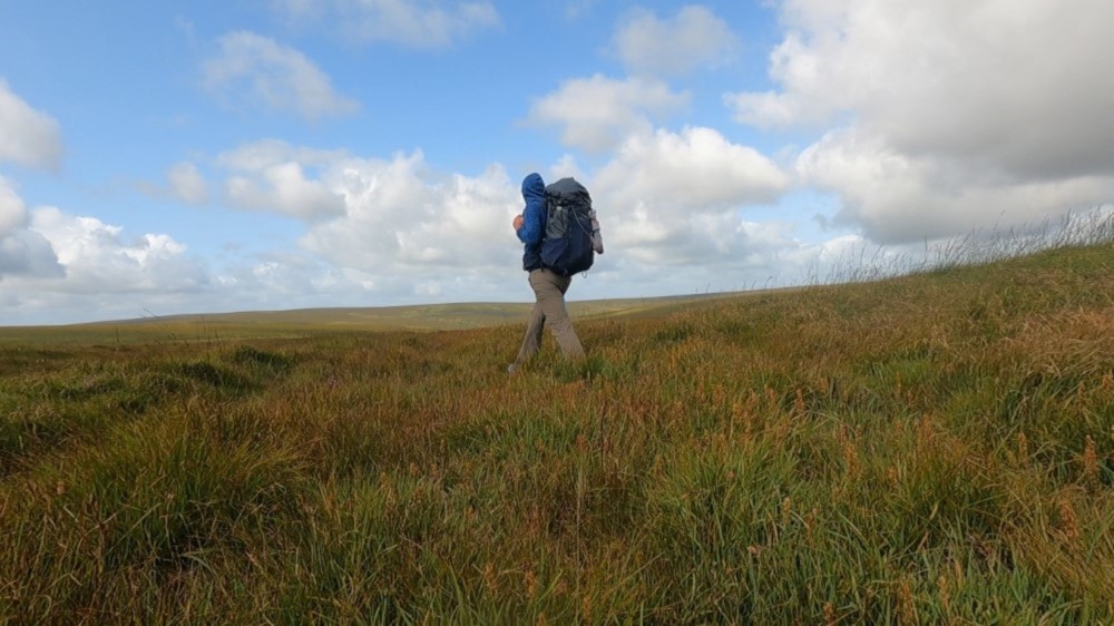
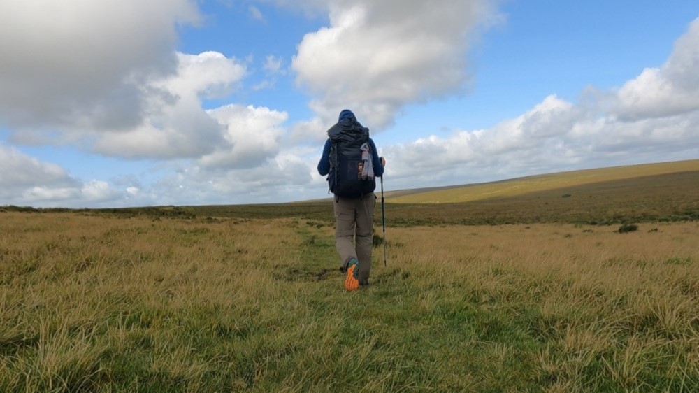
I pass the rest of the day between landscapes created solely by clouds, wind, and rays of sunshine. Hiking in Dartmoor has something meditative about it. The surroundings are uniform, sometimes even monotonous—endless plains of grass. It’s a bit like a desert. But just like in the desert it’s the absence of distinct features that becomes a liberating experience. You start to breathe freely and completely switch off because there are no distractions. The fact that there’s a hectic world out there—you forget that very quickly here.
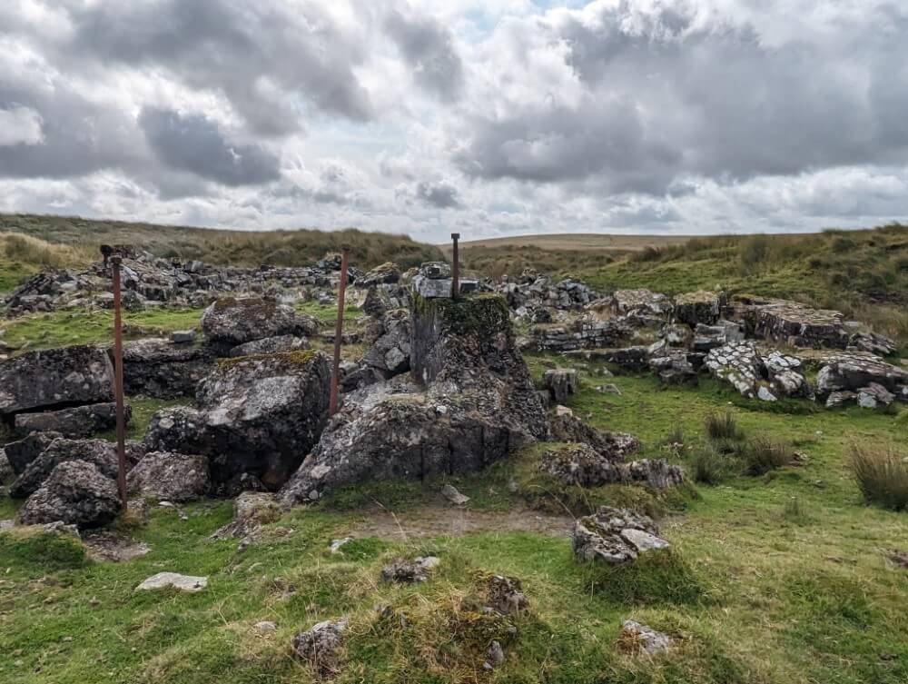
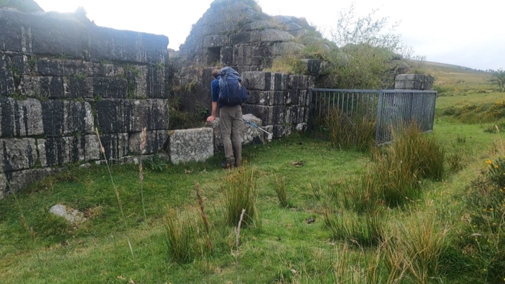
At noon I take an extended break at the ruins of the former tin mine Eylesbarrow. The weather has held up throughout the day. I use the sun to dry my sleeping bag. Then I continue and the landscape slowly begins to change. To my right a densely wooded valley appears, with long hills above crowned by sharp granite peaks. Wonderful! I could use a little variety by now.
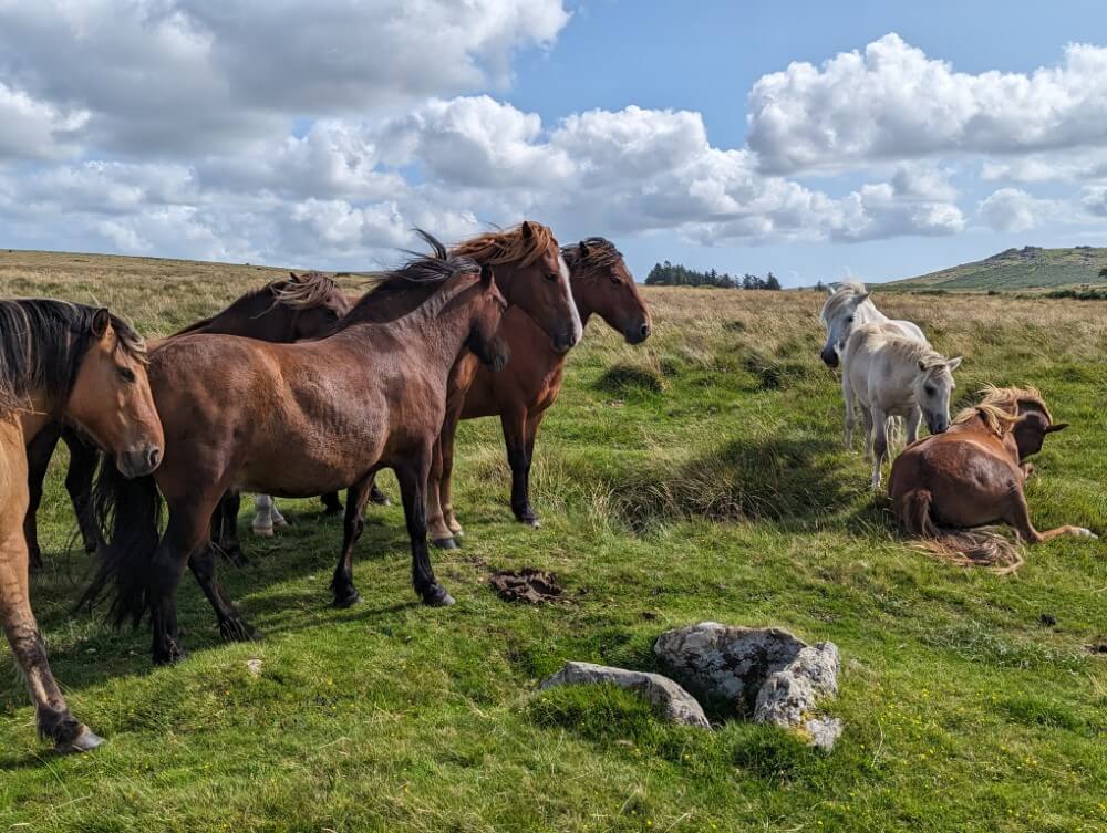
Passing a small woodland I ascend 369-meter-high Sheep´s Tor. An impressive viewpoint, it drops steeply into the plain to the west. Far behind, the green hills of Devon and directly below me, Burrator Reservoir shimmers emerald blue in the sunlight. The artificial lake is one of the largest water reservoirs in the region and it’s right down there where I’ll spend my second night.
The next day takes me back deep into the moor. First I stroll through the forests on the east shore of the Burrator Reservoir, pass the ruins of the abandoned Leathertor Farm, and reach the Crazy Well Pool. According to legend, this moorland pond is bottomless and was once a meeting place for witches. When I arrive, a few Englishpeople have indeed gathered to take a dip in the water. I pass on that. Although it’s midsummer, for my pampered continental sensibilities the weather isn’t nearly warm enough for swimming.
Exploring Fox Tor Mire
My next destination of the day is the infamous Fox Tor Mire. This is one of the largest swamp areas of Dartmoor and it has quite a reputation. The swamp also served to inspire Arthur Conan Doyle, the creator of Sherlock Holmes, for “The Hound of the Baskervilles.” In one memorable scene of the book, he has the faithful Watson observe a pony straying from the path and sinking into the mire, never to be seen again. The naturalist Stapleton later warns him about the dangers: “One wrong step in this bog, my dear Watson, means certain death for both man and beast.”
Well… it’s just a story. It can’t be that bad.
When I arrive at noon, to my surprise I find that a road actually leads up to the edge of the mire. And there’s even a small, obviously inhabited stone cottage with electricity and a parking lot where several buses from tour companies are parked. However, I don’t see anyone. So I leave the paved road and head onto one of the muddy footpaths leading into the swamp.
From a distance Fox Tor Mire looks relatively harmless. It’s a large basin, surrounded on all sides by low brown hills. The water flows down from the hills into the valley, gathers there and forms the swamp. My OS map does show a path that should lead straight through the mire and then along the western slope of Fox Tor (438 m) southward. This is the path I want to find. After that I plan to climb up to the even higher Aun Head Mire.
The first few hundred meters go smoothly, the faint path skillfully winds its way between the pools and the soft grass tussocks. Doesn’t look so dangerous after all. But eventually the path just ends and according to the map, I’d now have to march straight through one of the black pools.
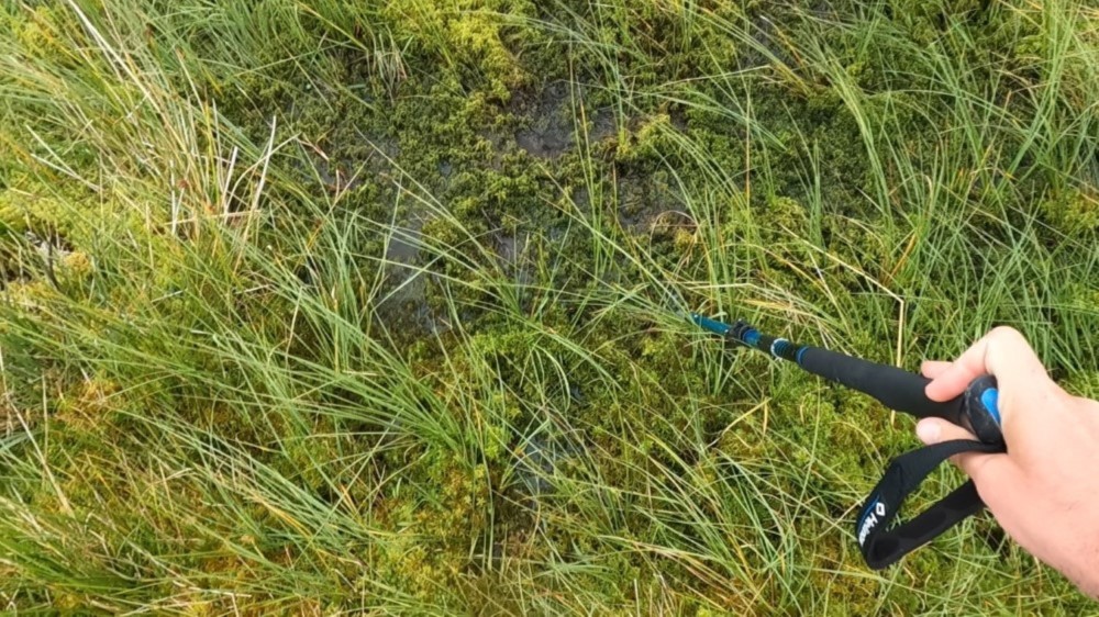
I’m not too keen on that but I don’t want to give up just yet. So I look for alternatives—it’s only a few hundred meters. Unfortunately, no luck there. All around me there’s nothing but black, gurgling water. I test the terrain with my trekking pole. I can´t find any solid ground, almost everywhere the pole sinks up to the hilt in the grass. What now?
In the end, I have no choice but to turn back. Up until this point Fox Tor Mire hasn’t been particularly dangerous and I’m not sure how deep I’d really sink into one of these pools. Maybe not even up to my chest? But there’s no need to take chances and just marching straight on would be pretty foolish.
The long way to Holne
So I take a wide route around the swamp area to the east. Along the way I discover an interesting path that leads me to a nicely situated weir on the River Swincombe. At the old keeper’s house, I take a coffee break using my camping cooker. In the end, the detour wasn’t so bad after all. I finally reach Aun Head Mire but I only view it from a distance.
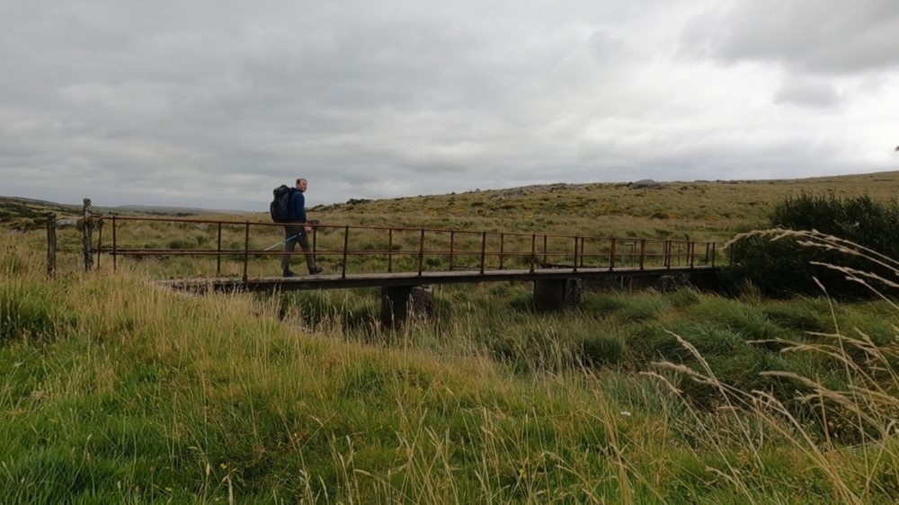
The only downside to all of this: The detour cost me some time. So I hurry along the rest of the way to Holne. The small village lies on the eastern edge of Dartmoor, above the Dart River which gives the moor its name. I plan to follow this river tomorrow and ascend to the northern plateau. Since I already saw on Google Maps that there’s a country inn in Holne, I’m hoping that I might spend the night in a bed for a change.
Unfortunately, Holne is also completely deserted. The place is tiny, no more than 50 houses. The inn only opens on the weekends and there’s not a soul around. After some searching, I do come across another very nice holiday home, the Walkers Retreat. But that’s more suited for couples and families, not forlorn looking solo hikers.
When I ask if I can stay for a night, the owner looks at me as if I’m begging for money. “Is that how you spend your vacation in Germany, just showing up without a reservation?” he asks. “We never do that here. That is so weird.” Okay, I got it. Guess it’s back to camping…
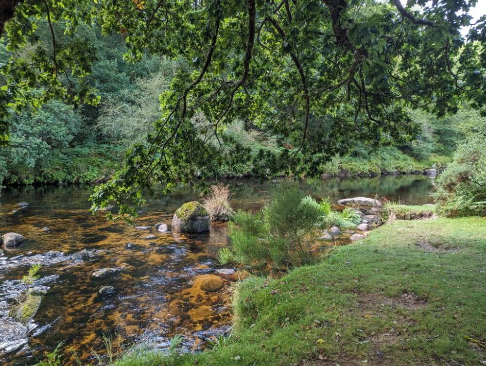
Although it’s getting dark, I descend into the deeply wooded, romantical valley of the River Dart. An hour later I find a campsite right next to the rushing river. It’s not ideal as the trail runs almost directly beside my tent. A few walkers with dogs are also around but they don’t say anything when they see me setting up my tent. I’ve been lucky. For one night it’ll work out somehow… no one will pass by after dark.
Actually, I do get a visit after all. Just before dark a lone hiker arrives at my campsite and makes himself comfortable on a large rock by the river for an evening picnic. “What is it with these crazy English people…” I think to myself and try to discreetly retreat into my tent. Eventually, though, I want to know what the guy is doing here at this hour. Turns out he’s not English at all but a German doctor living in Manchester spending his vacation at a nearby campsite. A little evening stroll… well, why not?
Jungle trekking in the Dart Valley
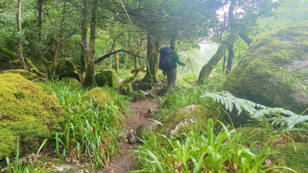
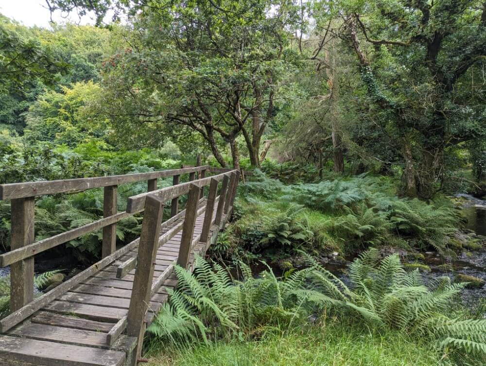
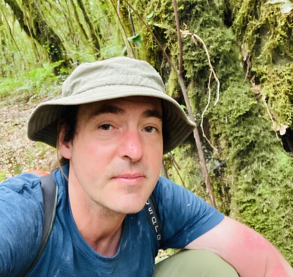
It’s still drizzling lightly as I set off in the morning. But the Dart Valley is densely wooded so it doesn’t bother me too much. What follows now turns out to be one of the highlights of the entire trip. The narrow forest path quickly transforms into a wonderfully overgrown jungle trail. I scramble over thick roots and loose rocks. The vegetation in the valley is almost primeval, the river is completely untouched by human hands. Everywhere around me, ferns are growing wild and the moss-covered trees add to the sense of untamed nature. The humidity is so thick it feels almost tangible.
It’s hard to believe this is still England. Actually, it reminds me more of my treks through the Selva, the rainforst of Peru – not without reason. As I later find out, the Dart Valley is a “temperate rainforest” that is, a rainforest of the temperate climate zone. These ancient rainforests are now very rare in Europe found only in a few locations. One of them is here in the southwest of England with its rainy coastal climate. Dartmoor never fails to surprise!
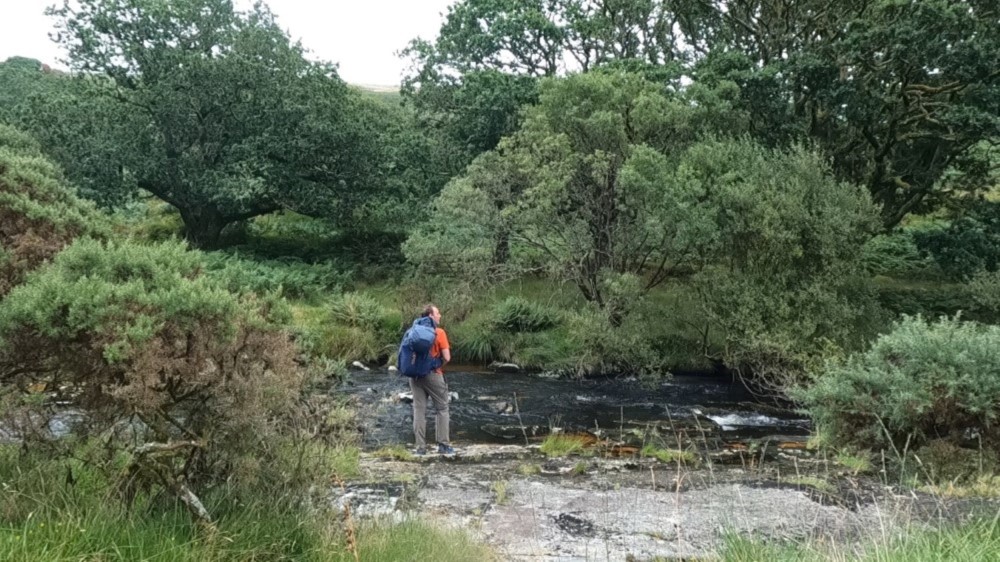
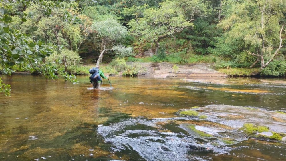
Another kind of surprise is an unplanned river crossing – all along the way the trail has at times completely disappeared. Luckily, the ford isn’t too deep but I still have to be careful as the rocky riverbed is completely smooth and therefore slippery.
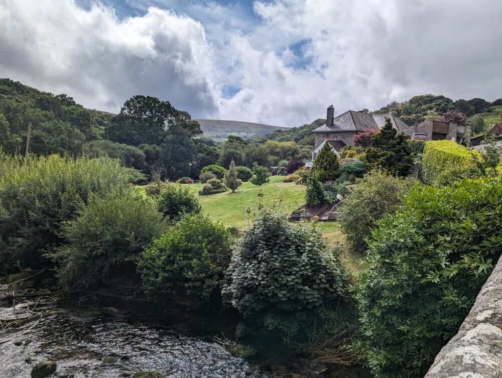
Finally I reach the village of Dartmeet which lies in a basin between the northern and southern plateaus of Dartmoor. Dartmeet itself consists of only 20 houses, a small café, a parking lot and a bus stop. Not much but enough for a quick break. Afterwards, I continue on my way climbing through Bellevere Forest onto the northern plateau.
In the afternoon I pass the great viewpoints of Laughter Tor (420 m) and Bellevere Tor (443 m). Later I come across another official path with the ominous name “Lych Way” (Corpse Way). The name dates from the medieval period: In order to bury their dead the inhabitants of the scattered farms had to walk more than 12 miles through the moor to reach the church in Lydford in the west.
Finally I cross the large B3212 road, one of the two roads that run through the heart of the moor. I had planned to continue on to the famous Wistmans Wood today but it’s already late and crossing the Dart Valley has taken more time than expected. So I end the day at the ruins of the Powder Mills, a former 19th-century gunpowder factory. Here I find a nice camping spot right by a stream in a small wooded area.
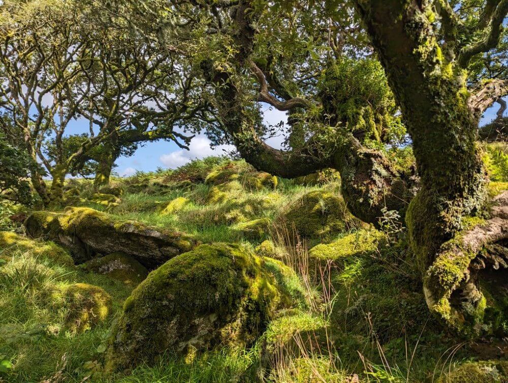
Wistmans Wood: Dartmoor’s enchanted forest
The next morning I continue. From my campsite it’s only three-quarters of an hour to Wistmans Wood. The forest is one of three remaining upland forests of Dartmoor. Until the Bronze Age, vast areas of the moor were covered by these forests. Later settlers cut them down over time to create grazing land. Even later Dartmoor was also used industrially with quarries, tin huts, peat bogs and the Powder Mill where I spent the night.
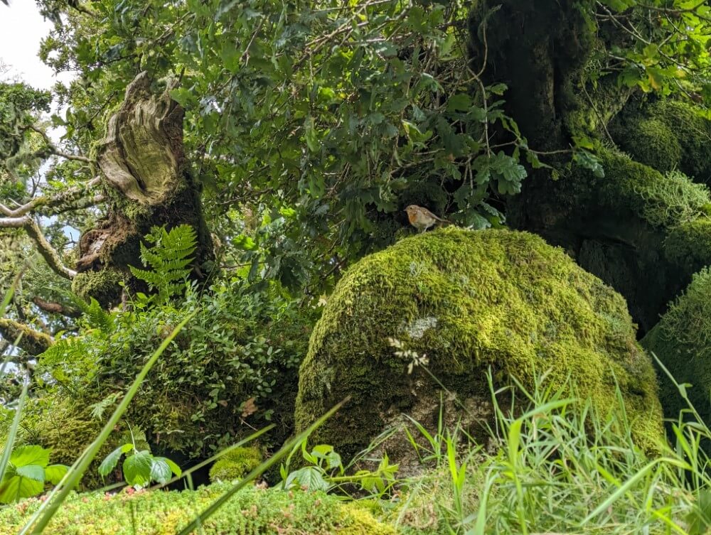
When I arrive in the valley where Wistmans Wood is located, I’m a bit surprised: It’s much smaller than the name “forest” would suggest. It’s actually just a small grove of oaks in a slightly sheltered hollow. But size isn’t everything and as I step under the leafy canopy, I´m quickly enveloped in a truly magical atmosphere.
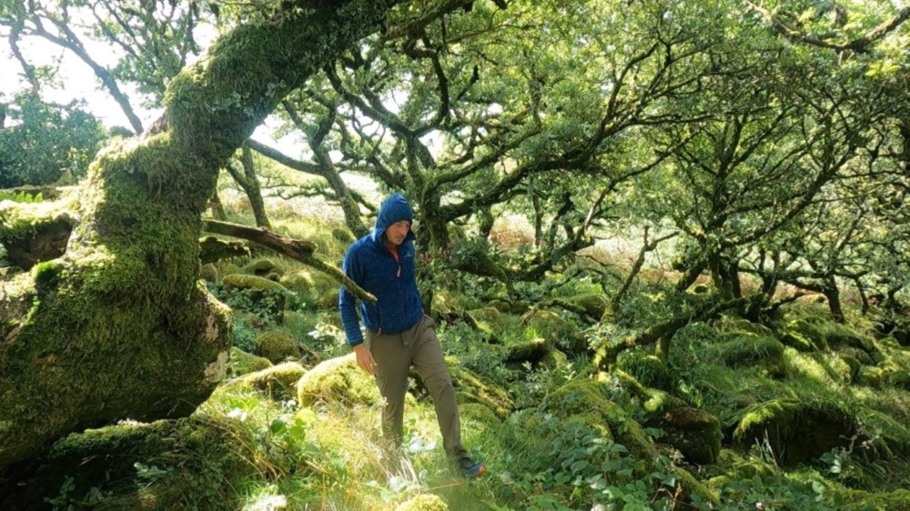
The gnarled, fantastically shaped branches of the wind-blown trees almost look like fingers. The ground between the trees is covered with irregular granite rocks, dotted with green moss cushions. A true enchanted forest, like something out of “The Lord of the Rings.” I half expect a forest elf to jump out from between the trees at any moment.
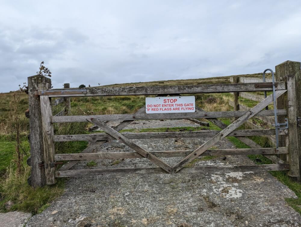
I continue through the Merrivale Range, one of the three areas also used by the British Army as a training ground. On a flat hill I spot a large post with a warning sign. Live firing in progress! But only at certain times and I had already checked the schedule before. When the army is conducting exercises, red flags are hung on the posts. Today, however, nothing is happening and I continue on to the western edge of the moor.
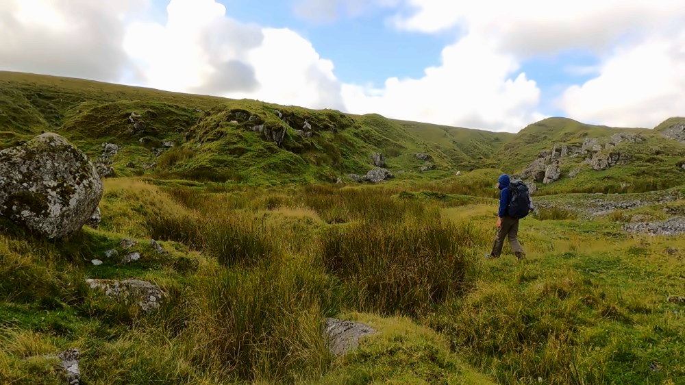
I now enter a more populated area, at least by Dartmoor standards. Before me stretches a wide valley with many scattered farms, through which the lower course of the River Tavy flows. The farms don’t exactly make navigation any easier. I’m still following the Lych Way, but the path often leads me straight through the countryside, cutting through fields and pastures.
The secret path into Tavy Cleave
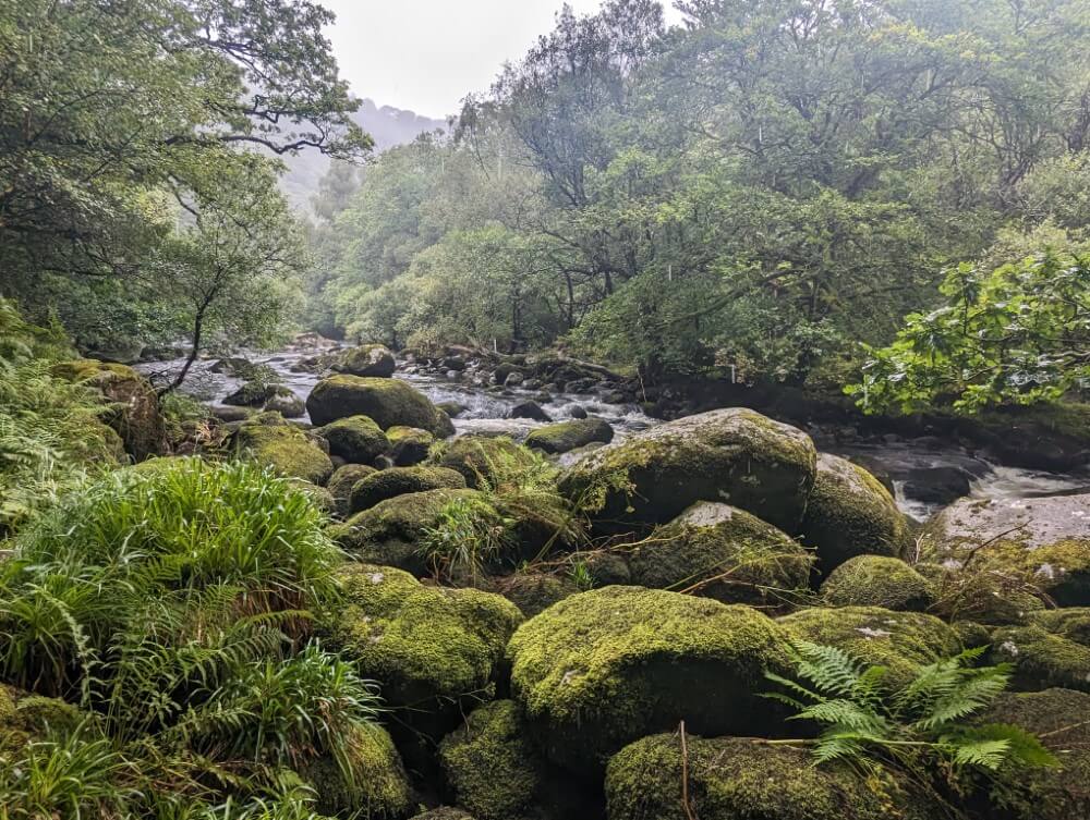
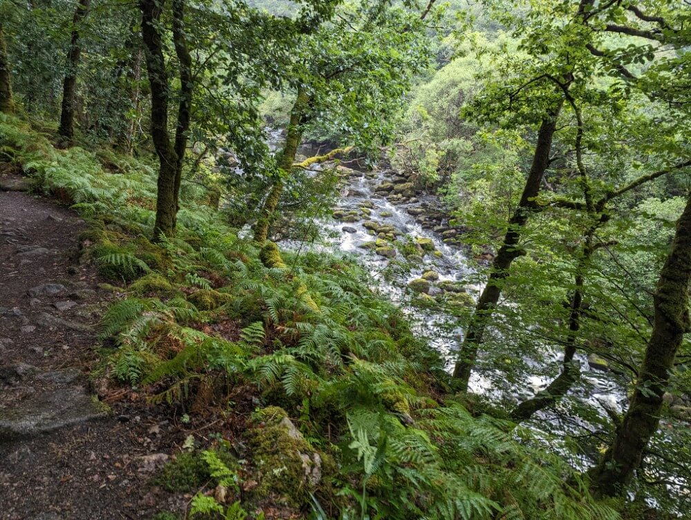
I follow vaguely defined cow paths, take shortcuts that end up in nowhere and find myself in front of closed farm gates more than once, forcing me to turn back. Finally, I have to ford the Tavy which reaches up to my hips. Two hours later I finally reach my destination: the isolated Nattor Farm at the end of a gravel road. Here the gorge opens, in the middle the river Tavy flows out of the northern plateau of Dartmoor. The “Tavy Cleave.”


Most of the valleys I’ve seen in Dartmoor so far have been relatively flat. However, the Tavy Cleave earns its name “cleave”. The slopes of the hills rise quite steeply and are covered with huge granite boulders with the stream winding through them like a narrow ribbon. It definitely feels a bit like a proper gorge, although of course the scale is much smaller than in a big mountain range.
The highlight, however, is the path through the gorge. It’s not marked on the maps. I discovered the old access path to a weir through travel reports and with the help of Google Maps. It first follows a narrow channel above the Tavy. Later, it turns into an adventurous footpath with various scrambling sections between giant ferns and dense heath grass. Wonderful! Unfortunately, it starts raining shortly after and it’s allready late anyway. So I end the day earlier than planned on a small grassy plateau right by the river.
Climbing Southern England’s highest mountain
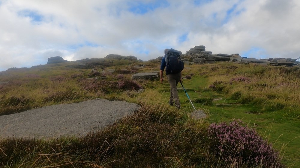
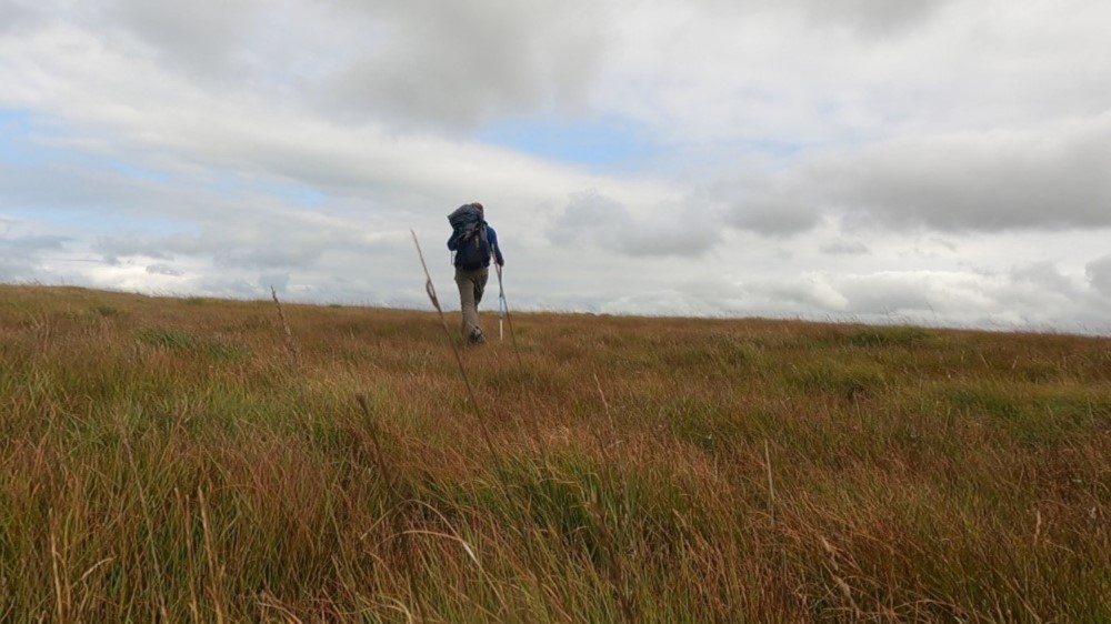
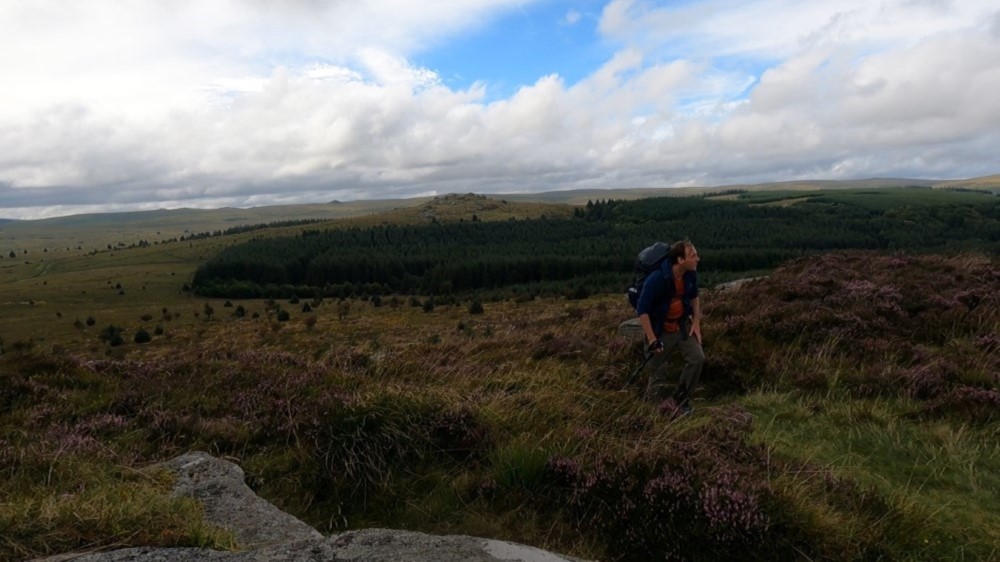
My sixth day of hiking begins in pouring rain. But at least in a few hours, I’m checking in to a warm hotel room in Okehampton – or so I believe at this moment. So, I pack up the soaking wet tent into my backpack and find the best route through the muddy gras slopes on the west side of the Tavy. I’ve now reached the Willsworthy Range, the highest part of Dartmoor. Here rise the highest mountains, not just of the moor but of all southern England.
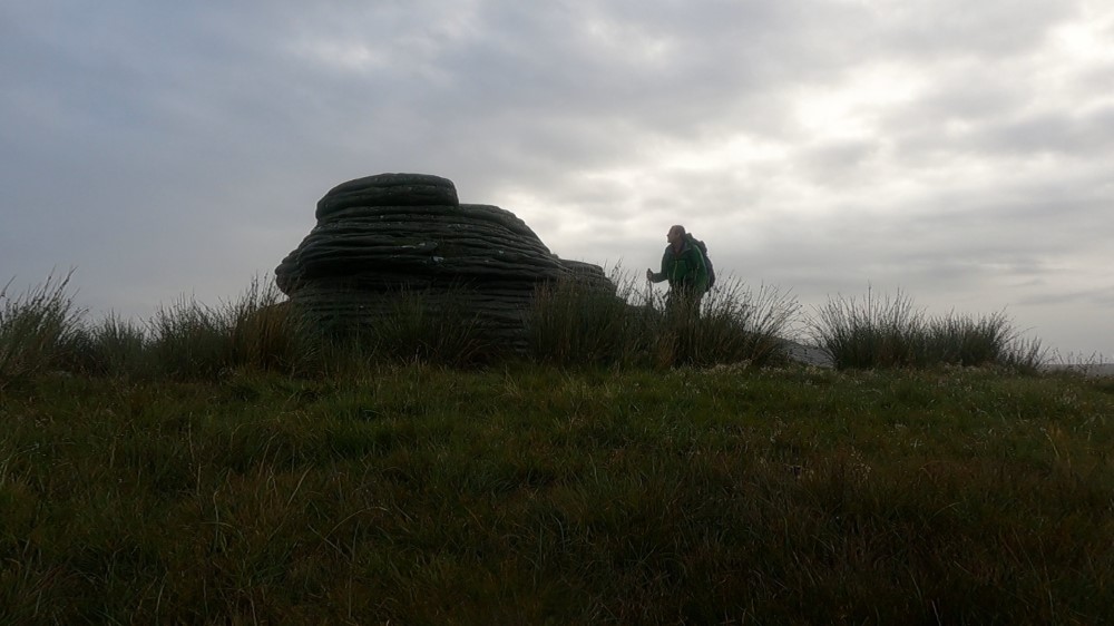
The rain is driving, low-hanging clouds drift across the scene, but the views over the vast land open up every now and then. To the west of me, Hare Tor rises with its two prominent rock peaks, alongside impressive Sharp Tor, whose jagged granite crown almost resembles a castle wall. Shortly after, I reach Chat Tor, the highest of this trio at 541 meters. At this moment, though, it looks more like a large, petrified cowpat.
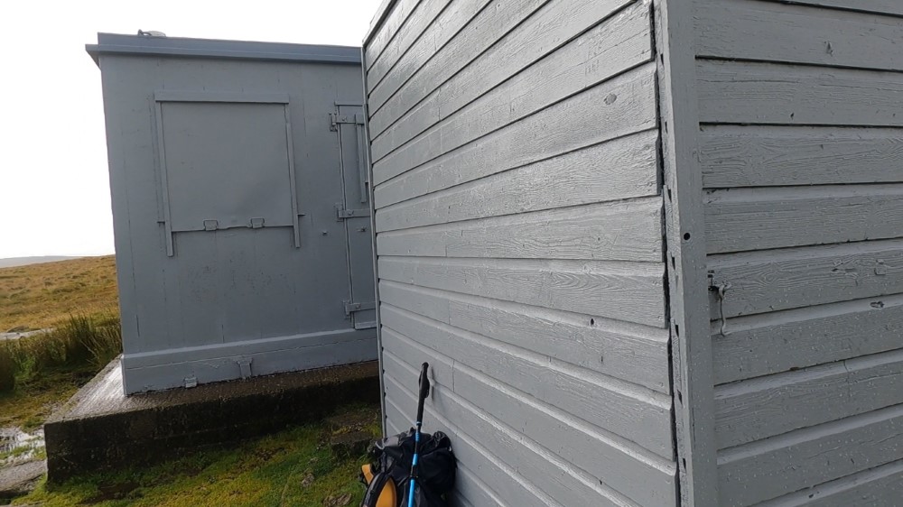
At a marvellously remote ruin with the fitting name Bleak House I come across a more clearly defined gravel path that leads me over a dam to the former peat extraction site at Rattle Brook. The weather also improves a bit now. Shortly after, however, the path dissolves again and I march up the next larger hill without a trail. Here, I’m in for a real surprise: a small British Army outpost.
After a short break, during which I enjoy the stunning views, I descend into the valley and climb up the other side. I have to ford the West Okement River, but it’s very shallow. I don’t even bother taking my shoes off for it. They’ve been soaking wet for days alread, and it’s quite pointless to try to keep them dry. Sooner or later, they’ll be wet again anyway.

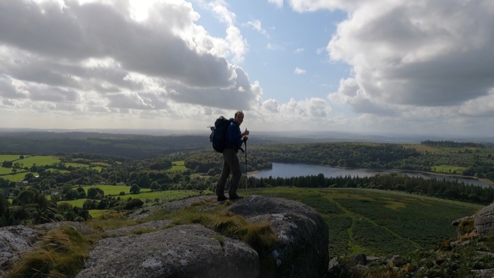
Once at the top, I pass another army post. Then I find myself on a wide grassy ridge that shortly leads me to High Willays Tor, at 621 meters the highest (and only true) mountain in southern England. Of course, I can’t resist marching to the smooth summit.
A few hundred meters further on, I also summit Yes Tor (619 m). Admittedly, these mountains aren’t the tallest. Actually they just feel like slightly oversized molehills. But the views are beautiful and it doesn’t always have to be about the biggest height. I enjoy one last look at the vast, wild landscape I’ve traversed over the past few days. Then, I begin the descent back into civilization.
Farewell to Dartmoor
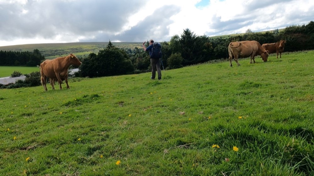
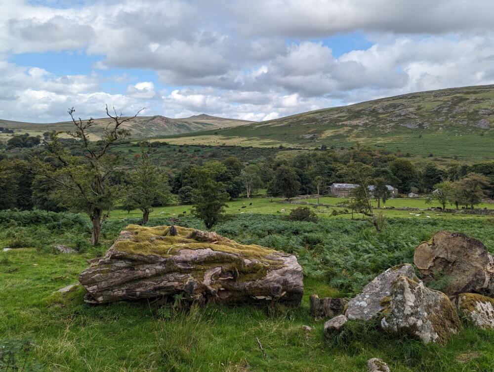
The rest is really just a formality. Shortly after Black Down Tor begins an asphalt road that leads me down to Okehampton in the valley, passing the large army camp. The wide, open land of the rugged moor quickly fades behind me. The surroundings turn more friendlier as I enter the gentle, green hills of Devon—a charmingly unspectacular landscape of hedgerows, country lanes, and of course, the countless stone walls of the “enclosures,” perhaps the most typical feature of the English countryside.
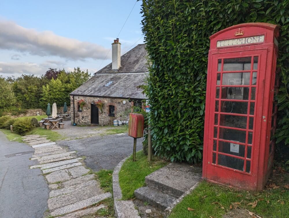
In Okehampton, I didn’t make a reservation. I thought the town was big enough that I could just show up and find a room. Unfortunately, I thought wrong. It’s Bank Holiday and the only two hotels in the town are fully booked. Although everyone is very friendly and helpful, even trying to arrange something via Airbnb, nothing works out. I mentally prepare myself to find some illegal wild camping spot somewhere in the vicinity of the town. So much for drying my things…
In the end, the British Youth Hostel Association saves me. The landlord at the London Inn tells me that the YHA runs a hostel with a campsite right next to the train station. He suggests I try there. And I do have some luck: The hostel is also full but camping is allowed. So I pitch my tent for another night before catching the train north to the famous Lake District the next day – not what I expected but a quite fitting end to my hike through wild England.


Now on to some practical tips if you want to do this or a similar hike in Dartmoor yourself.
How to get to Dartmoor
The nearest major city with an airport is Bristol. From Bristol, it’s best to continue by train. Two good places to start tours in Dartmoor are:
- Ivybridge (southern Dartmoor)
- Okehampton (northern Dartmoor)
That’s exactly where I began and ended my hike. Both places are connected to the rest of England by the Great Western Railway, travelling through Exeter where you may have to change trains. The train ride from Bristol to the Dartmoor area takes about 3 hours.

It’s also possible to travel from London. Expect about 4 hours of travel time. Trains run fairly regularly and are not too expensive. For example, I paid only about 30 euros for the Okehampton – Bristol route. I booked all my tickets through the Trainline portal, which I can recommend. The prices are sometimes even cheaper than booking directly with the train company, thanks to split-ticketing.
Accommodation
Devon is sparsely populated and, from what I gathered, not one of England’s top tourist destinations. Therefore, the towns around Dartmoor are not exactly overflowing with accommodation. However, there are usually at least a few Bed & Breakfasts, AirBnBs or vacation rentals that can be found on Google Maps. Most visitors stay for a longer period in one place. Overnight stays for just one night seem to be rather uncommon.

In Okehampton, I checked out two hotels:
- The Fountain Inn & Riverside Restaurant
- The White Hart Hotel
I would have really enjoyed staying there after the hike. Unfortunately, neither had availability. Both hotels looked very cozy, are located directly in the town center next to the Dartmoor Museum and each has an attached pub on the ground floor. The Fountain Inn is quite reasonably priced for English standards. A more affordable alternative with a bit less comfort is the youth hostel with a campsite right by the station (about 35 euros/room, 15 euros for a campsite).
About the trails in Dartmoor
The paths in the high moor are 99% unmarked. Most of the time, they aren’t even proper trails but narrow tracks in the grass. It’s often hard to tell whether they are made by humans or animals. On top of that, there are countless boggy patches. As a result, it’s almost inevitable to occasionally veer off the correct path. The potential to get lost is definitely there, especially in poor visibility.
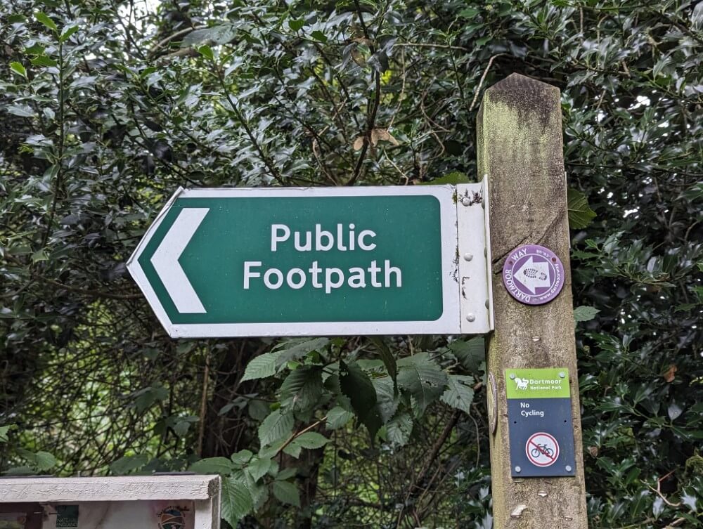
Parts of Dartmoor are used as grazing land for sheep and cattle. On the edges of Dartmoor, you’ll occasionally find signposts labeled “Footpath.” However, the destination of the footpath is usually not indicated. Therefore, it is almost essential to bring a map and/or use a smartphone or GPS device for orientation. Keep in mind that there is mostly no mobile phone reception in Dartmoor.
The National Park authority advises that hikers should be able to use a map and compass before venturing into the interior of Dartmoor. I think a compass is not 100% necessary, if you use electronic navigation. However, having a physical map for emergencies is handy. Also, the vast landscape with mostly clear sightlines is very well suited for taking bearings with a compass. Plus, you can move around freely and are not strictly bound to paths. So, if you ever wanted to practice using a compass in open terrain, Dartmoor is an excellent place to do so!
I use this compass:
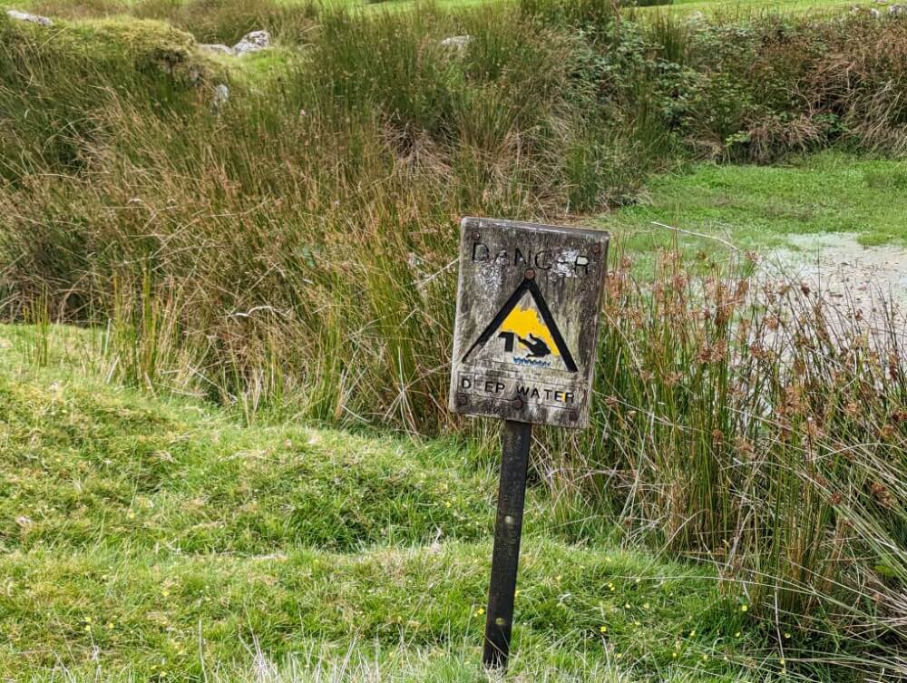
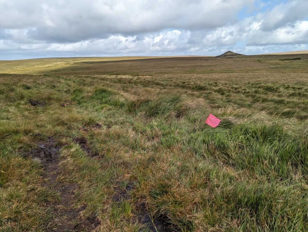
Swamps in Dartmoor
In addition to the ubiquitous Blanket Bog, puddles, small streams and wet grasslands, there are several large swamp areas in Dartmoor. These include:
- Fox Tor Mire
- Aun Head Mire
- Raybarrow Pool
The latter is considered the most dangerous swamp, people have gotten lost there and had to be rescued. My impression was that it’s usually quite easy to recognize where a deep swamp begins. It’s not as if the swamp will suddenly swallow you without warning. However, it’s definitely a good idea to carry a trekking pole to test the ground in front of you. If the pole doesn’t find any resistance after 20 centimeters, it’s best not to go any further!
Wildcamping
Dartmoor is one of the few places in England where wild camping, or “backpack camping,” is not only tolerated but officially allowed by law. A few nature reserves are exempt from this and wild camping is not permitted in the immediate vicinity of villages. The permission applies exclusively to pedestrians, not for overnight stays in motorhomes, etc. An overview can be found on the following interactive map:
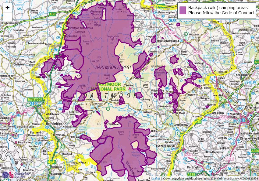
Important: Pay attention to army training times
The British Army regularly conducts maneuvers in the northern part of Dartmoor, during which live ammunition is fired. There are three danger zones in total:
- Willsworthy Range
- Merrivale Range
- Okehampton Range
The boundaries of the zones are marked on the OS map and they can be entered by pedestrians without restrictions. During a maneuver, red flags are flown or red lights are lit at night in the surrounding area. Access is restricted during these times. The respective dates are announced on this website with a six-week lead time.
Equipment and necessary clothing
I found the highlands of Dartmoor to be very windy and significantly wetter than the already rainy southwest of England. Therefore, good rain protection is essential. Not necessarily to prevent yourself from getting wet (which is hard to avoid here), but to protect against hypothermia and to keep your sleeping bag, etc., dry. For the trip described here, a tent, provisions, and camping gear are also required.
Rain Protection
As usual, I had my Montbell Stormcruiser jacket as rain gear, along with the Marmot PreCip Eco Pant rain pants. Both served me well and, combined with a fleece jacket (a cheap model from Kathmandu), helped prevent cooling down. However, it’s worth noting that the English rain brings normal Goretex-jackets to their limits. After a few hours, it’s almost inevitable that you’ll still get wet. The combination of an umbrella and poncho is not ideal for Dartmoor due to the strong winds.
I found it particularly important to keep my sleeping clothes and sleeping bag dry. For that, I used a Sea to Summit dry sack as usual. My trekking backpack, the Exped Thunder 70, is considered highly water-resistant, but a little water still made its way through the seams.
Shoes
Before the trip, I got a new pair of trail runners, the Altra Timp 5. These are very comfortable trail running shoes that, at least for my feet, fit better than the well-known Altra Lone Peak with their overly large toe box. For the terrain in Dartmoor—narrow trails and pathless or nearly pathless grassland—these lightweight shoes are well-suited. In my opinion, heavy hiking boots are not necessary.
My shoes were not waterproof but I suspect even the most waterproof shoes in the world will get wet in Dartmoor sooner or later. The best approach is to simply accept that you’ll eventually get wet feet. In reality, it’s much less of a problem than it sounds at first and you get used to it quite quickly in lightweight shoes.
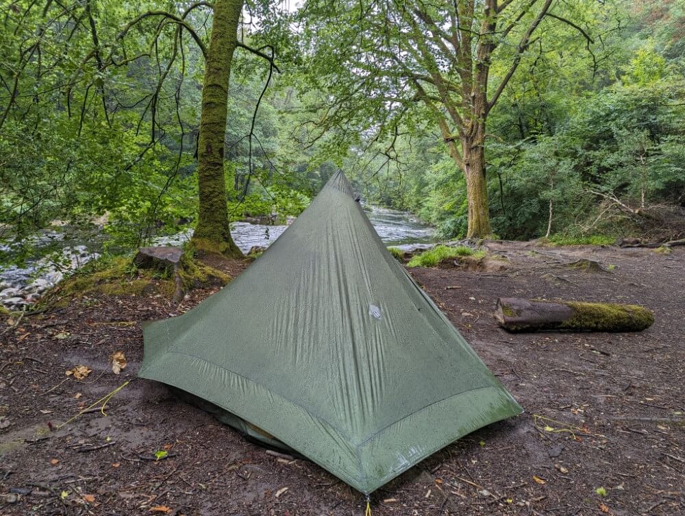
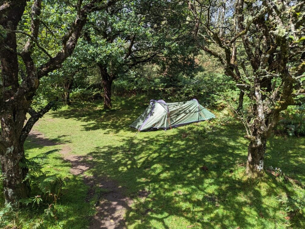
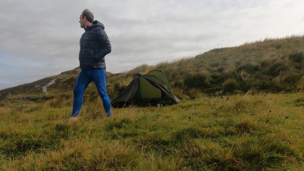
Tent
For a tent, I brought my 1-person Lunar Solo. To be honest, that was an experiment because I wanted to see how such an ultralight model performs in real weather conditions. Surprisingly, I have to say: not too bad. Despite some very strong gusts of wind, the tent held up safely overnight. However, it did let a bit of rain in under the tarp and I also had quite a bit of condensation. My Hubba Hubba NX 2 would probably have been a little drier.
Sleeping Bag
As always, I had my down quilt, the Katabatic Palisade, with me, which worked well with a comfort temperature of about 0°C. Of course, the quilt got a little damp at night, but it wasn’t too bad. I always dried it during the day when the sun came out, and that worked well. If you’re not doing week-long trips in constant rain and you securely store your sleeping bag in a stuff sack during the day, you can use down even in this weather.
Provisions and Water Supply
For multi-day trips you’ll need provisions, which are better bought in a larger nearby city like Plymouth or Exeter. Ivybridge and Okehampton have only very small supermarkets, though the selection in Okehampton was a bit better.
As the trip report will have made clear, water supply in Dartmoor is not a problem. However, it’s not particularly pleasant to drink directly from a moorland puddle, and the water in the streams is heavily sedimented. A water filter is better. I used my Sawyer Mini as always.
One more tip: Be cautious when collecting water near former tin mines. Here, the ground is likely to be at least partially contaminated. The ruins can be identified on the OS map by the label “tin workings.”
Climate and best time for hiking in Dartmoor
Dartmoor is visited by most people between spring and autumn. I would guess there is no real “best time to visit” for hiking, as each season should have its appeal. July and August are peak season, supposedly drier and busier. Personally, I didn’t notice much of that. There weren’t many people out, nor was it excessively warm.
England in general is rainy year-round and Dartmoor sees even more rainfall than average. During my trip in August, I had light rain almost every day for 6 days, with heavy rain on 3 days. Even in mid-summer, it rarely gets warmer than 20°C, and the wind makes it feel even colder. The climate is definitely cooler than in continental Europe. But for hiking, that’s not so bad.
My verdict
Who would have thought that walking for several days with wet feet could be so much fun? I certainly didn’t. But you wouldn`t do Dartmoor justice if you reduced it to a big swamp. In reality, it’s a surprisingly varied landscape. I especially loved the mystical forests and the wooded river valleys. Couple that with the vastness of the high moor… truly unique.
Also, Dartmoor is wild and remote but with a bit of common sense hiking here is not particularly dangerous. This makes it a great hiking region for people who want to experience the wilderness without diving into complete solitude for weeks. The icing on the cake: You can camp to your heart’s content, plus it’s easily accessible. Which leaves only one question: Why didn´t I visit Dartmoor much sooner?
Did you enjoy reading this guide? Then support the blog and treat me to a virtual coffee.

Without coffee I won’t get out of bed and can’t have new adventures:)
Note: This article contains affiliate links marked with an asterisk (*), which lead to online retailers like Amazon. If you click on one of these links and make a purchase I receive a small commission that helps fund this blog. It’s the best way to say thank you if you enjoyed the post. Of course, this does not incur any additional cost to you.
Do you have questions or tipps for Dartmoor? Do you know any other exciting and wild hiking regions in England? Then head straight to the comments – I look forward to hearing from you!