
In this article:
- The 5 best day hikes in Pokhara
- Phewa Skywalk: Pumdikot to the Peace Pagoda
- The Pokhara Panorama Ridge: Sarangkot to Naudanda
- Phewa Backside: The Hidden Lakeside Trail
- Magical Machapuchare: The Tea Gardens of Lwang
- Annapurna for Beginners: The Dhampus Hill Hike
- How difficult are the hikes?
- Practical info: getting there, supplies, gear and the best time to hike
- Final thoughts
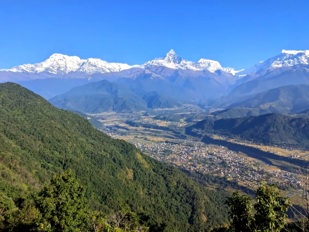
Pokhara is, without question, Nepal’s backpacker capital and a place that feels genuinely blessed by nature. Set in a wide basin with Phewa Lake at its heart, the biggest city of Kaski district is surrounded on all sides by river valleys and the lush green foothills of the Himalaya. Less than 20 kilometers to the north, the snow-capped giants of the Annapurna range rise on the horizon.
In other words: climb almost any ridge on a clear day, and there’s a very good chance you’ll be rewarded with one of the most spectacular mountain panoramas on the planet.
Interestingly, hardly anyone seems to go hiking in the surrounding hills. Paragliding or a boat ride on Phewa Lake – sure. A few adventurous souls maybe make the short climb up to the World Peace Pagoda for the view. But that’s about it. Beyond that, most of Pokhara’s trails remain largely untouched. Which is surprising, because these routes are easy to reach, offer incredible views and aren’t particularly difficult.
A hidden treasure, just waiting to be discovered.
On my last trip to Nepal, I spent over two months based in Pokhara – and a big part of that time was dedicated to exploring exactly this: day trips, short hikes, and excursions into the surrounding hills. What I found were incredible viewpoints, authentic traditional villages, beautiful nature trails—and barely any other tourists. These hikes ended up being one of the highlights of my entire trip, and a big reason why I enjoyed Pokhara so much.
In this guide, I’ll show you my five favorite hikes.
Overview map of the hikes (click to enlarge):
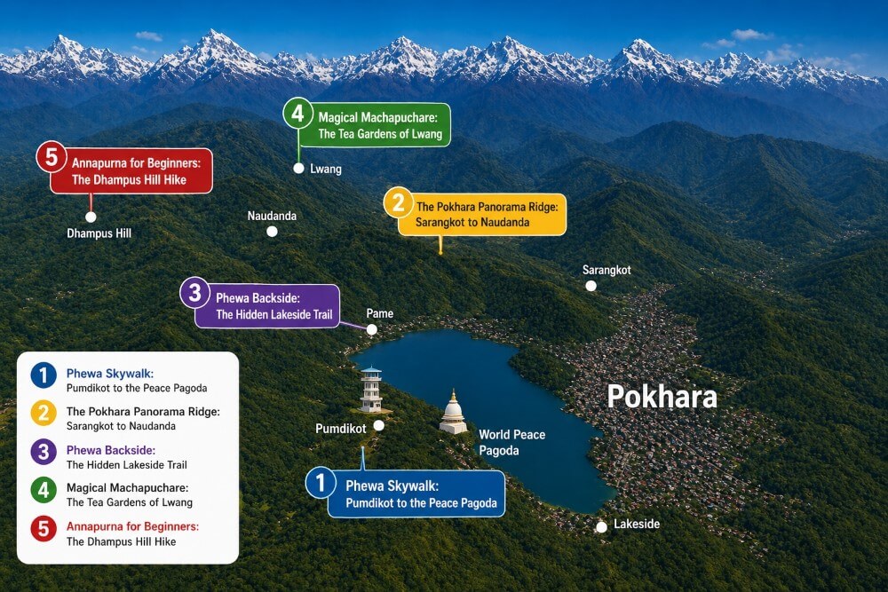
The 5 best day hikes in Pokhara
All the hikes featured here are easy day trips starting from Lakeside. The idea is simple: head out to the trailhead in the morning, enjoy the hike, and make your way back to Pokhara in the afternoon or evening.
My criteria for a great hike were pretty straightforward:
- ✅ Great views & interesting highlights along the way
- ✅ Easy to reach with bus connections back to Pokhara
- ✅ Natural trails – I’m not a fan of road walking
- ❌ No permit or guide required – all hikes can be done independently
- ❌ No long transfers – maximum 30 minutes to the start
- ❌ No extreme difficulty or excessive elevation gain
With that in mind, I ended up with five standout routes: five hikes around Pokhara that are genuinely worth your time and so good that they deserve a closer look here.
Let’s go!
Download the GPS Tracks

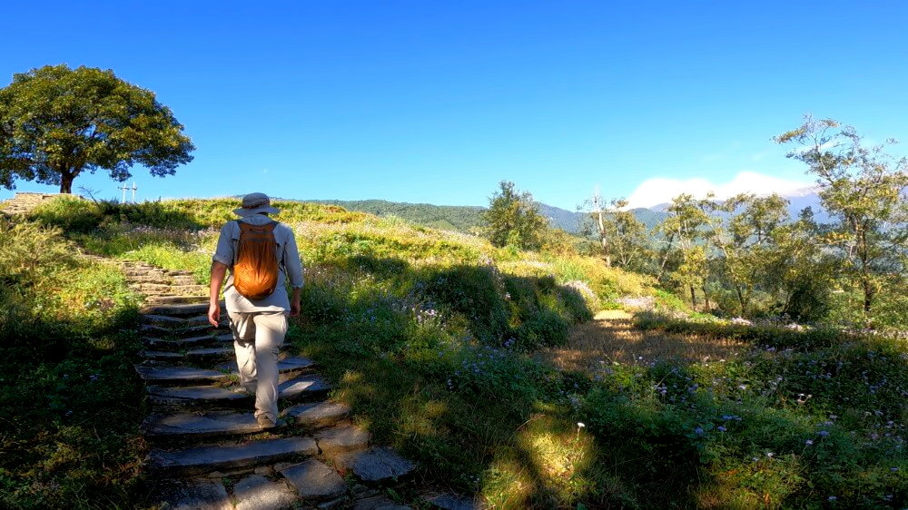
Phewa Skywalk: Pumdikot to the Peace Pagoda
Distance: 3.5 km · Duration: approx. 3 hours · Difficulty: easy
⛰️ Elevation gain: +150 m / -660 m
🔎 Notes: short, easy hike, ideal for half a day
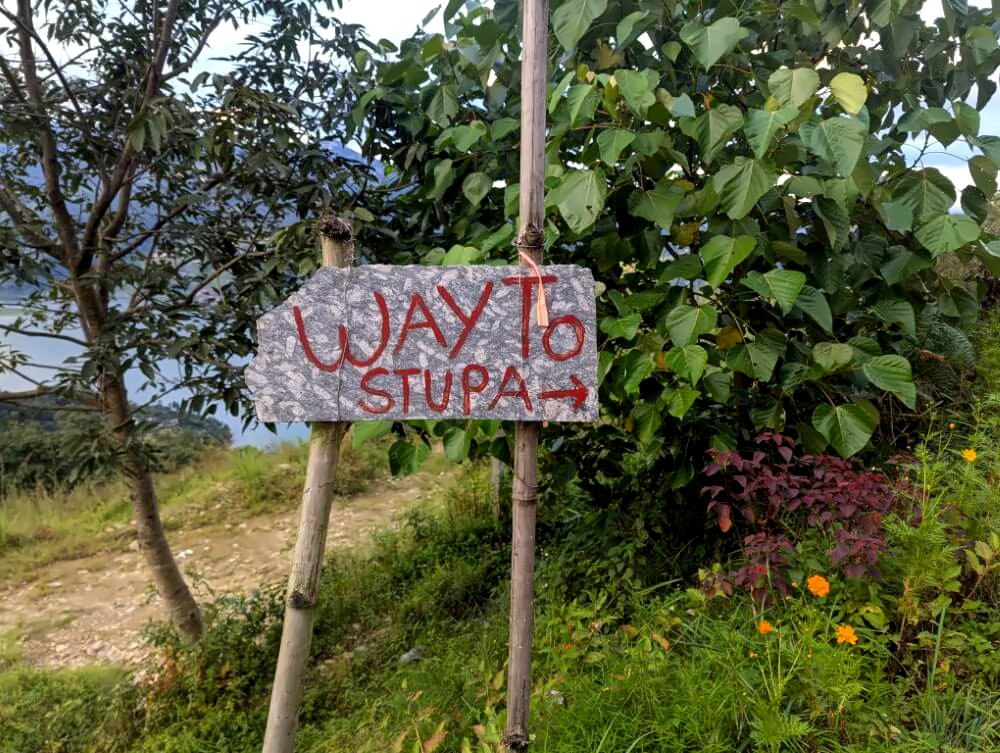
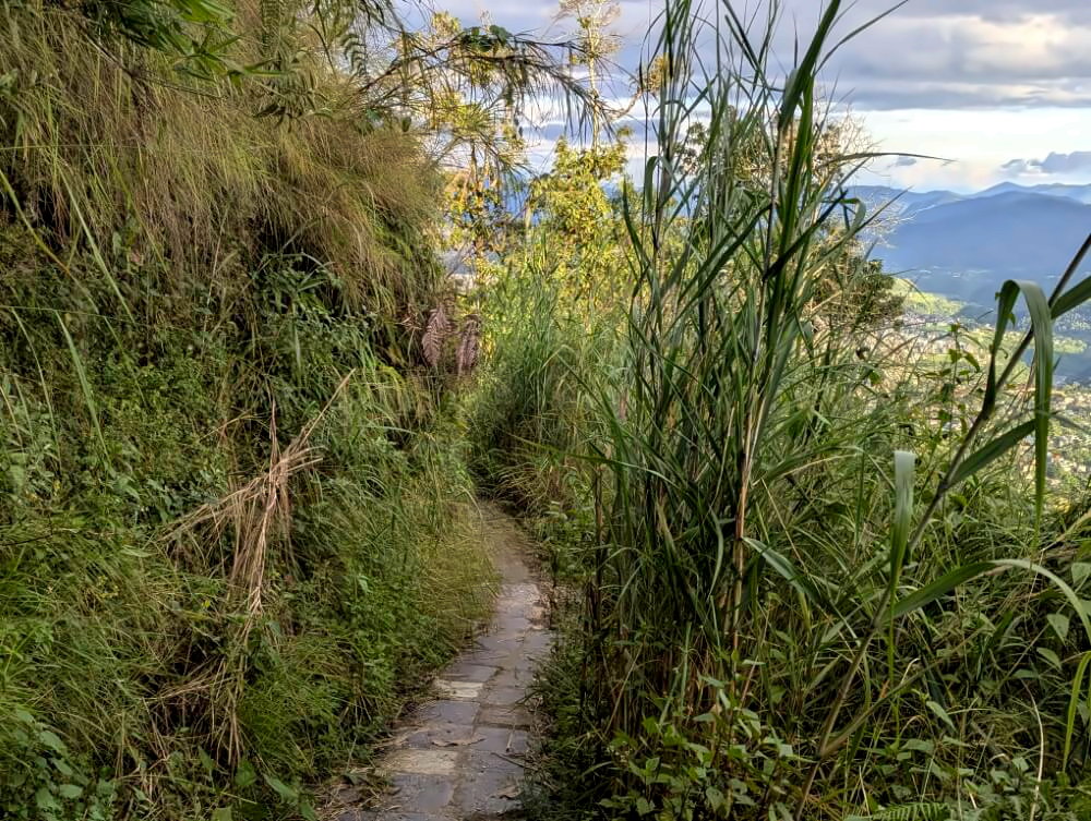
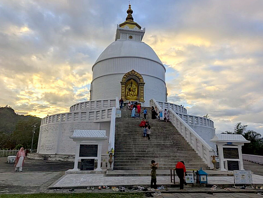
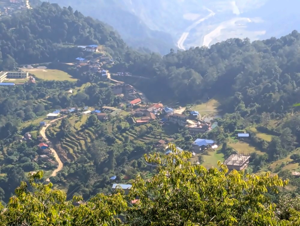
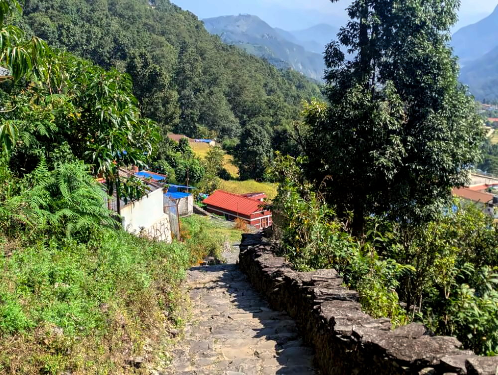
A great one to start with: this short and easy hike links two of Pokhara’s best viewpoints into one relaxed walk – perfect if you’re a bit short on time. Many visitors hike up to the World Peace Pagoda from below, which is fairly strenuous and offers limited views. This route avoids that by starting higher up and then gently descending toward Phewa Lake.

Route description
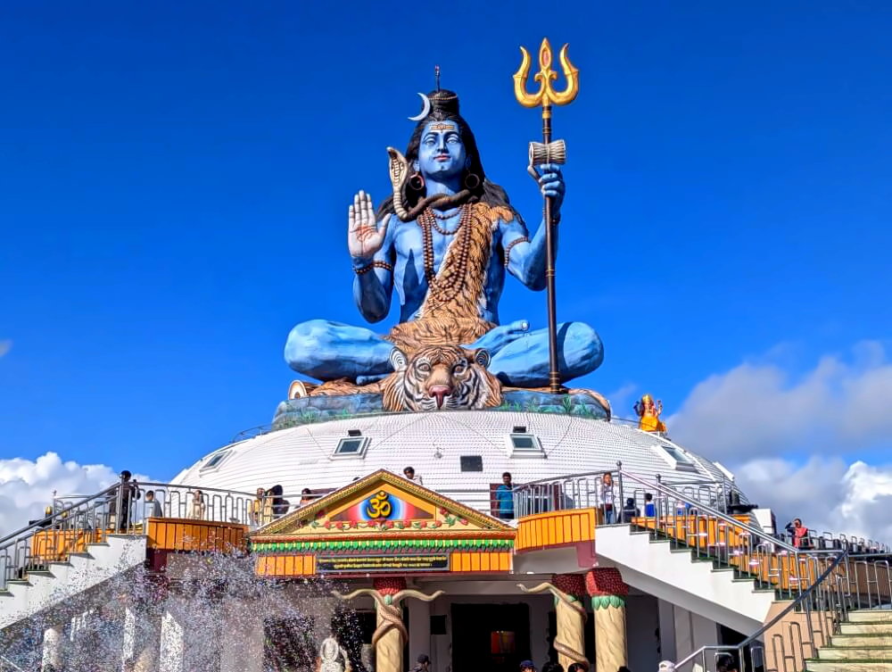
The hike begins at the towering Pumdikot Shiva Statue, which offers fantastic views over Phewa Lake. The quickest way to get there is by taxi (around 1,500–2,000 NPR from Lakeside), though local buses from the Baglung Bus Park also run in that direction. Around the statue, you’ll find several small restaurants and kiosks where you can stock up on snacks and supplies.
From the statue, head into the village of Pumdikot. In the center, turn onto a side road that soon transitions into a well-maintained nature trail – the same path locals use to walk down to the lake. Follow the steadily descending stone steps through the forest, pass a great viewpoint, and keep right at the fork toward a nearby resort. Eventually, you’ll reach a road with another scenic viewpoint and a small snack stall.
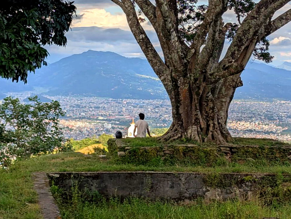
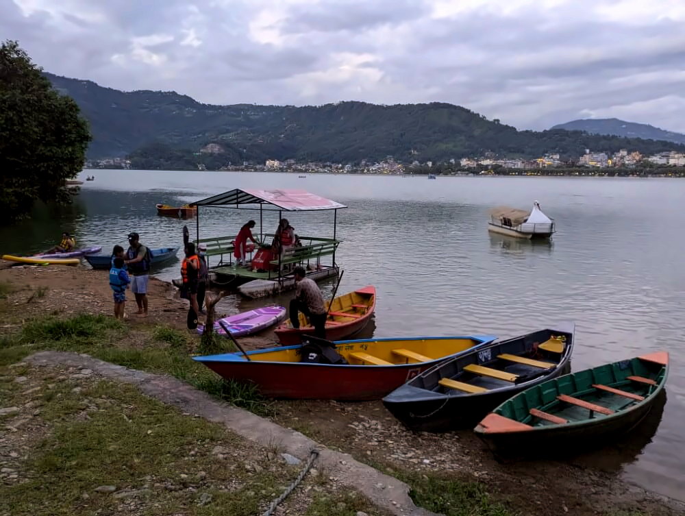
After a short stretch on the road, turn off in the village of Dhunge Pani onto an easy-to-miss trail. This path leads past the “Happy Swing” viewpoint and continues on to the World Peace Pagoda. After taking in the panoramic views over the lake, continue down a final set of stone steps to the boat landing. From here, you can take a boat back to Lakeside (around 650 NPR). If you time it right, you’ll arrive just in time for the evening Aarti ceremony, held daily around 5:30 pm on the shore opposite the Tal Barahi Mandir.
Photo gallery:
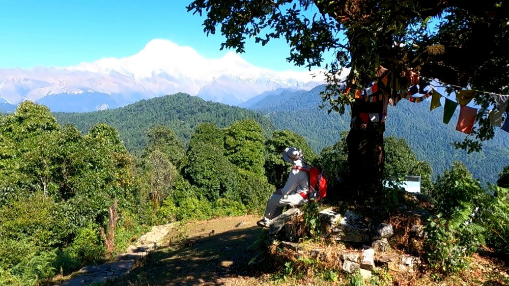
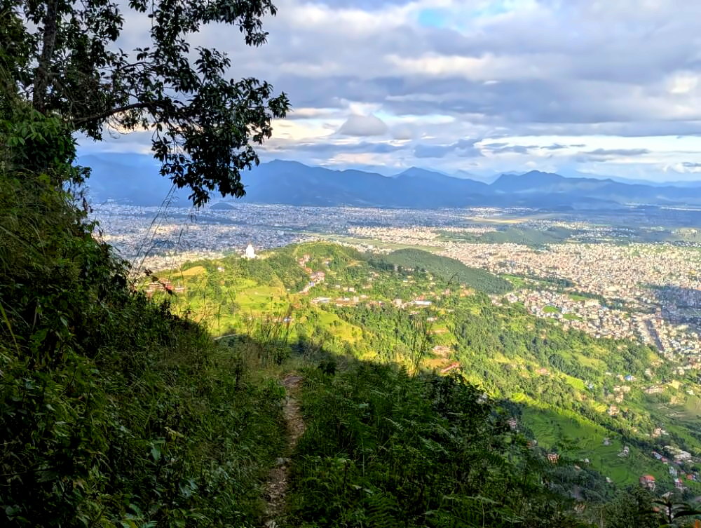
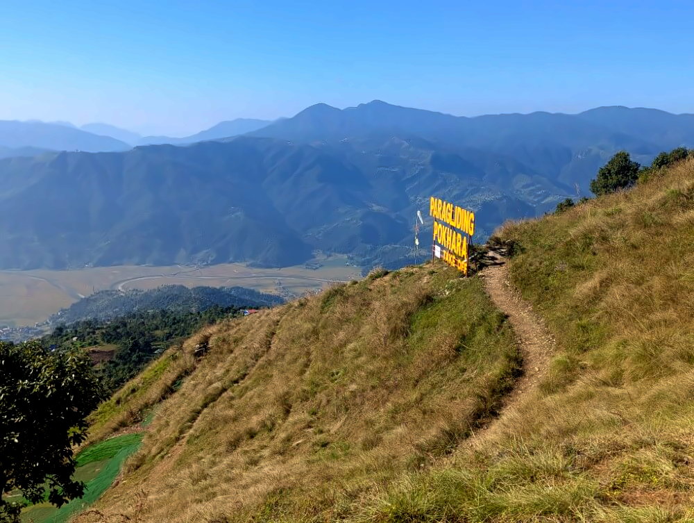
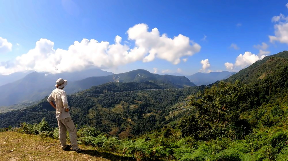
The Pokhara Panorama Ridge: Sarangkot to Naudanda
Distance: 12 km · Duration: 6–7 hours · Difficulty: easy to moderate
⛰️ Elevation gain: +760 m / -880 m
🔎 Notes: long hike, some ups and downs in the middle section
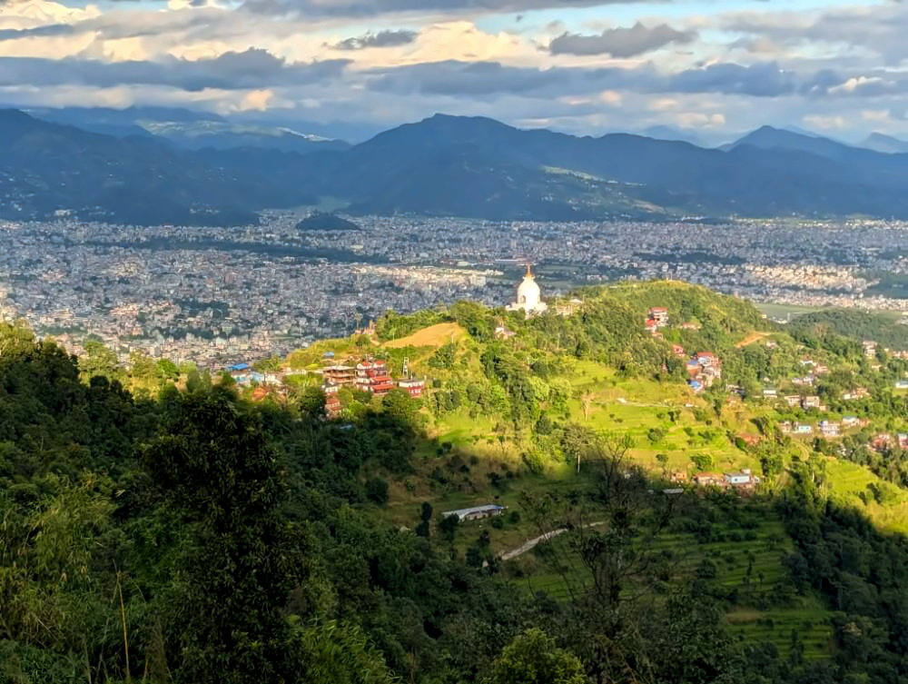
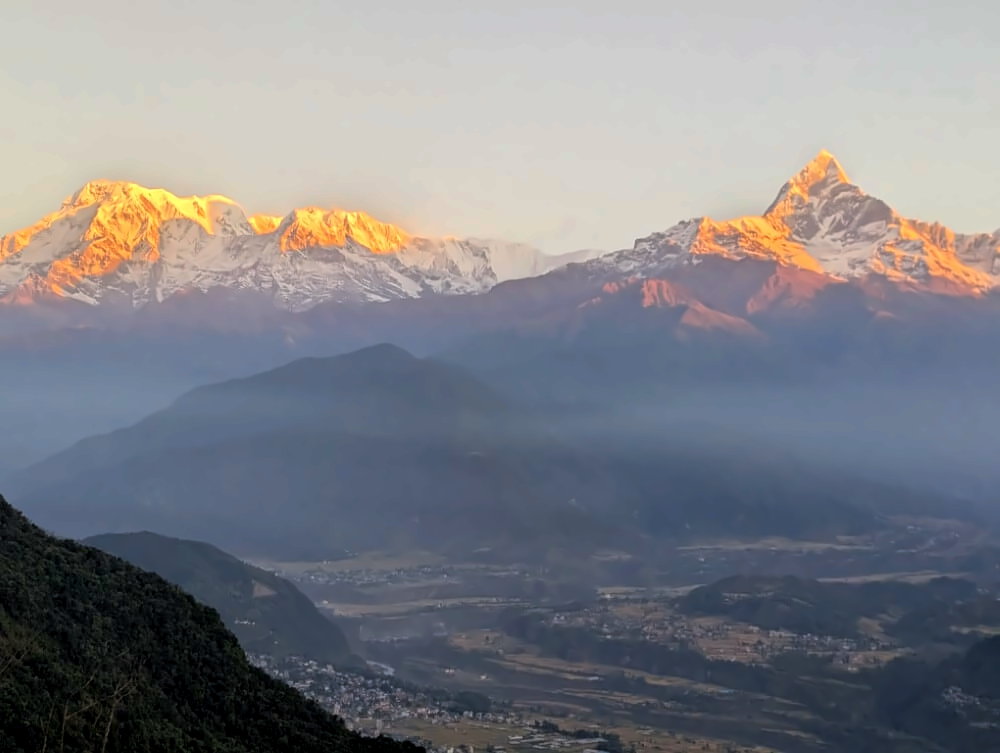
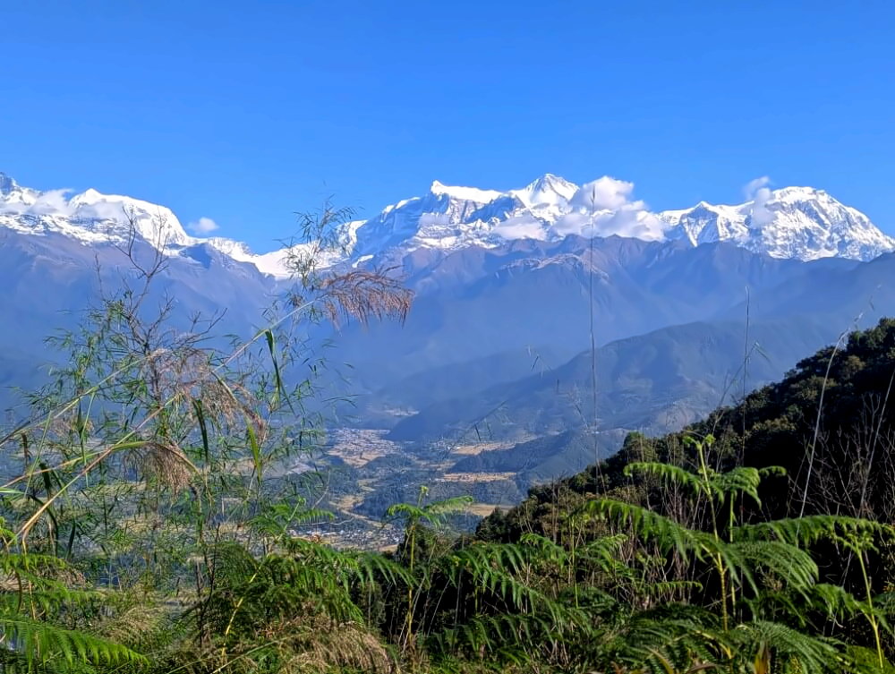
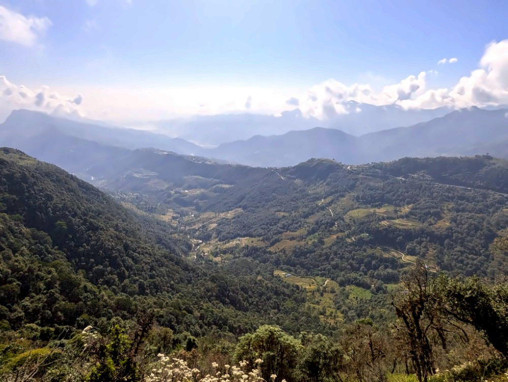
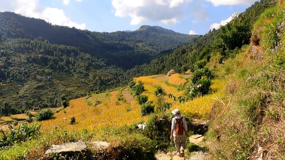
The ridge walk from Sarangkot to Naudanda is the perfect day hike. For the entire way you follow the mountain ridge separating the Phewa basin from the Seti Valley – the views are simply outstanding. To your left, the shimmering Phewa Lake stretches out below. To your right, the full Annapurna range rises into the sky with views reaching all the way to Dhaulagiri. Paired with sunrise in Sarangkot this is arguably the best day hike in all of Pokhara.
Route description
The hike begins at the well-known viewpoint in Sarangkot – ideally right at sunrise. The easiest way to get there is by taking the Annapurna Cable Car from above Lakeside. The hiking trail up to the viewpoint is steep, tiring, and offers limited views, so the cable car is the better option. After soaking in the first incredible views of the Annapurnas, follow the road briefly. At the grounds of the Pokhara Zipline, turn left onto a natural trail.
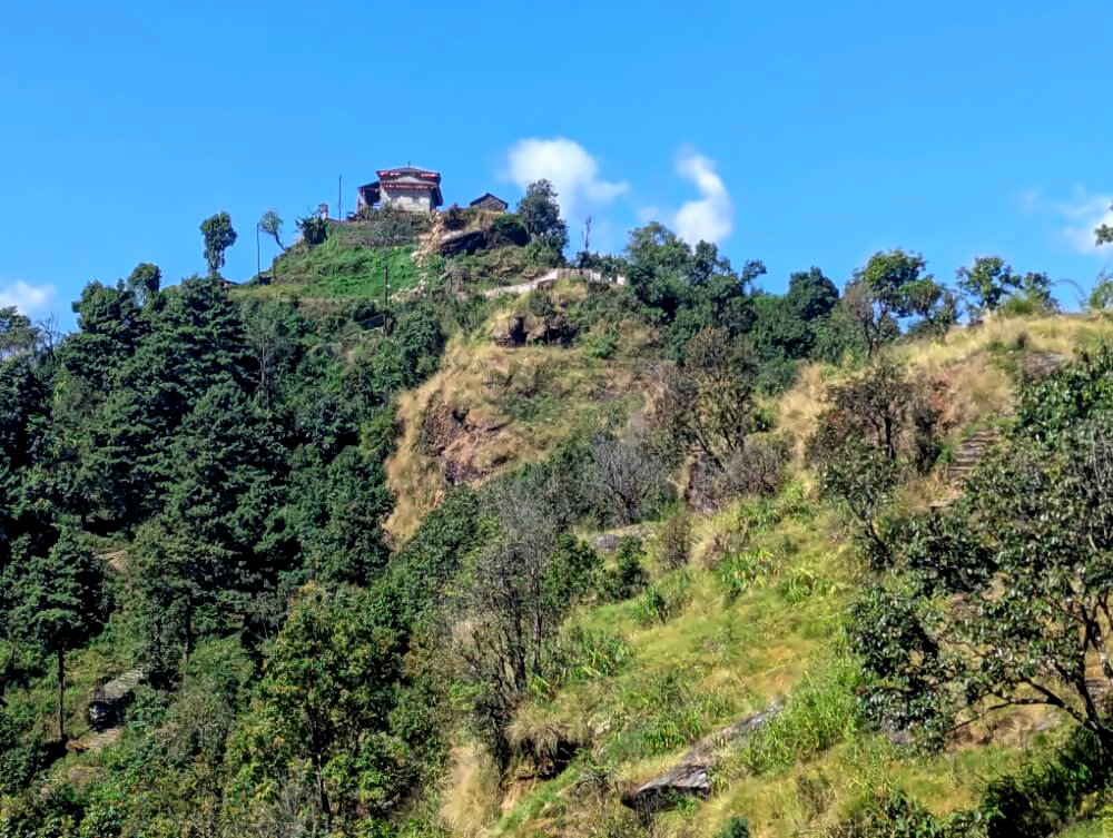
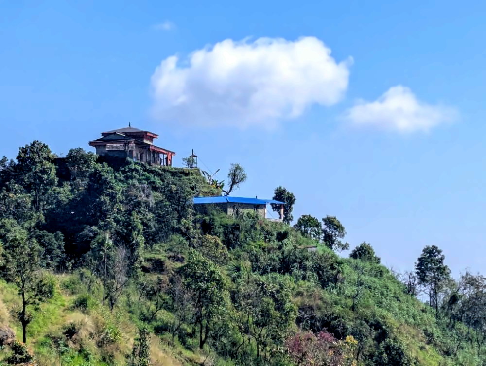
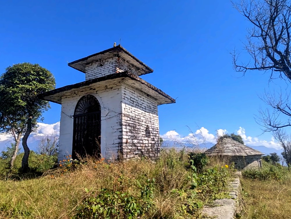
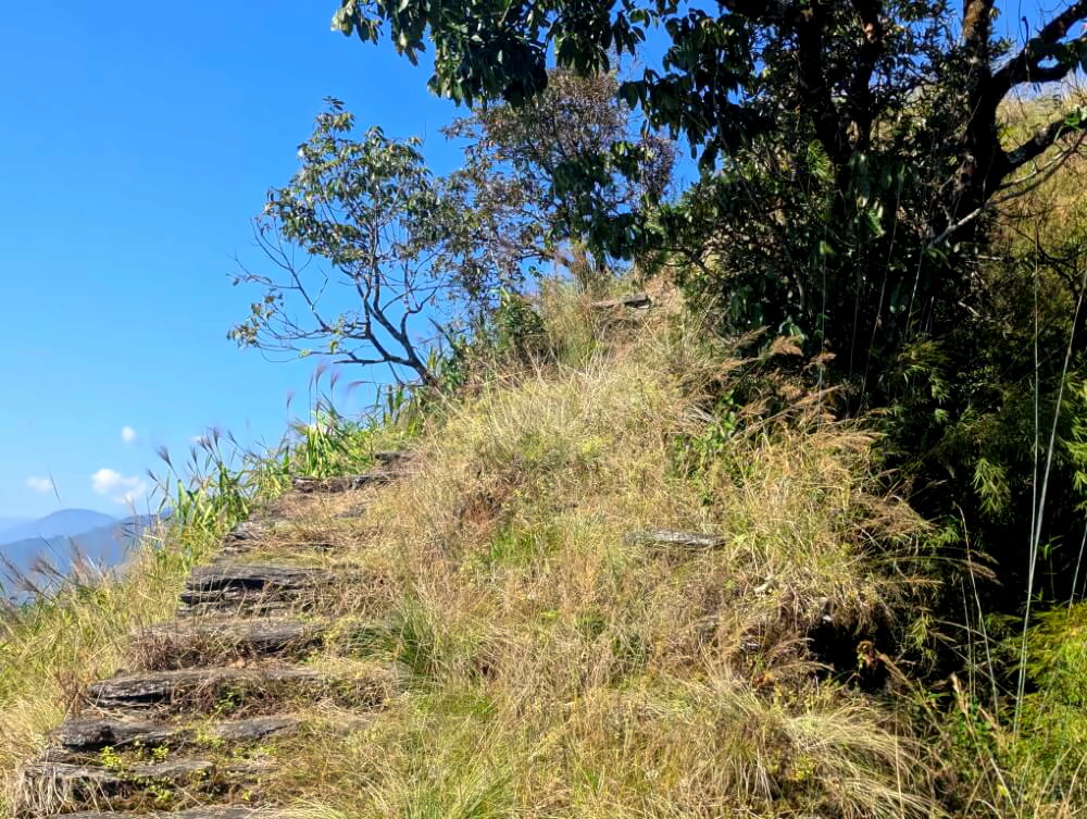
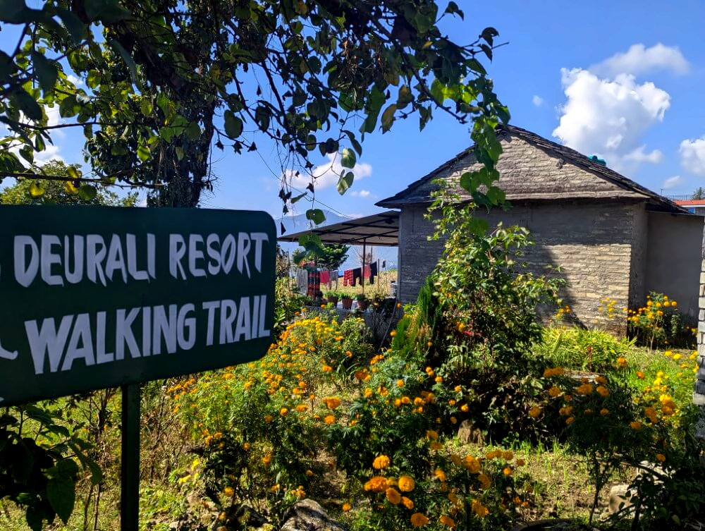
From here on, the route is straightforward: just follow the natural line of the ridge. One of the highlights – besides the sweeping views – is the series of small temples perched on the hilltops along the way. The trail undulates gently but is never overly demanding. About halfway through, you can take a break in the village of Deurali. From there, continue on a newly built trail to Naudanda, where you can catch a bus back to Pokhara.
Photo gallery:
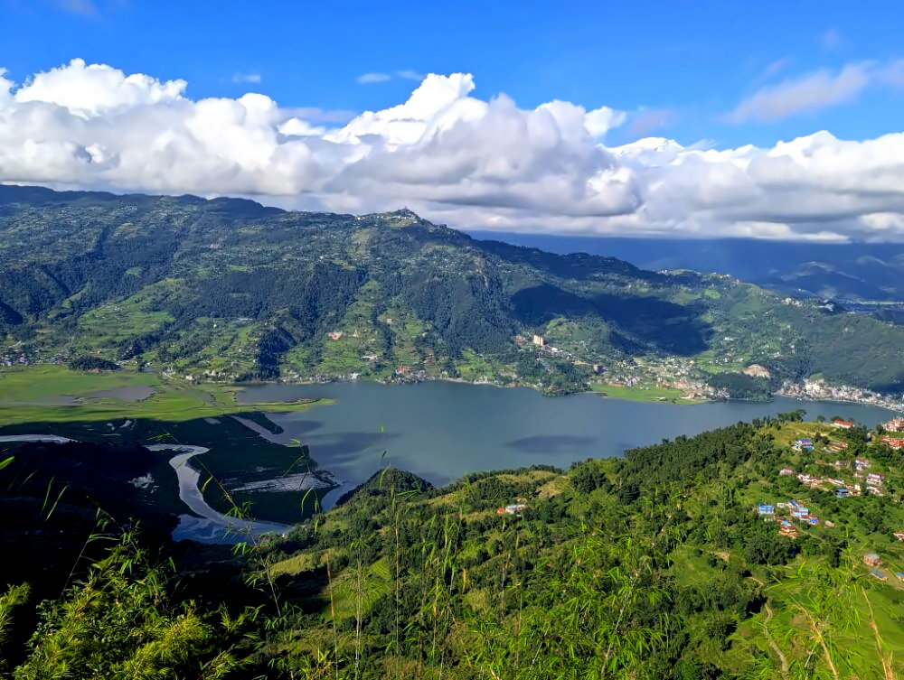
Phewa Backside: The Hidden Lakeside Trail
Distance: 12 km · Duration: 5–6 hours · Difficulty: easy to moderate
⛰️ Elevation gain: +945 m / -935 m
🔎 Notes: some slightly overgrown sections in the second half
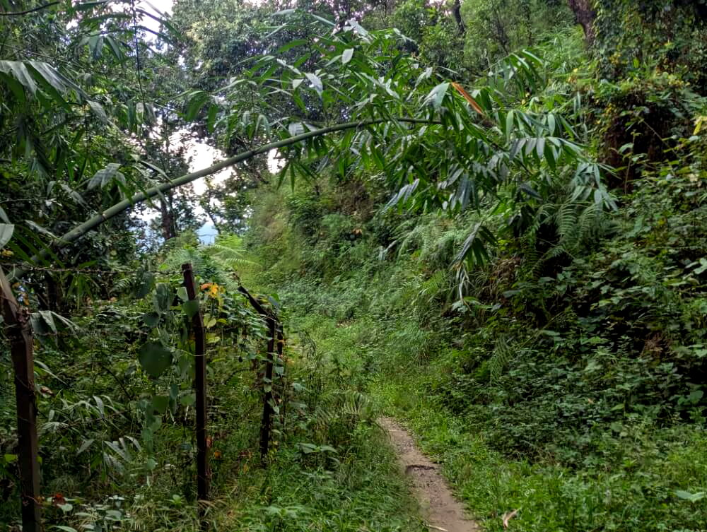
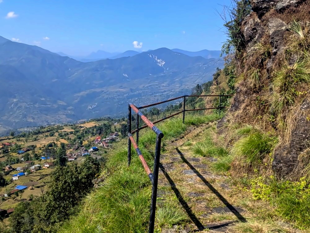
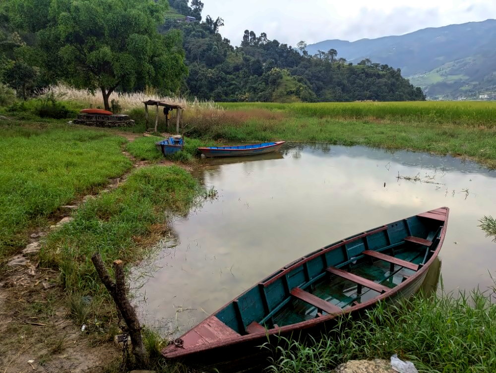
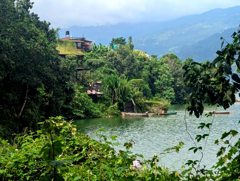
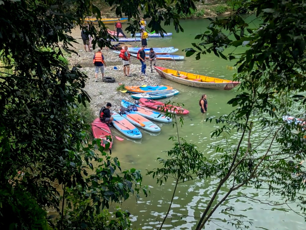
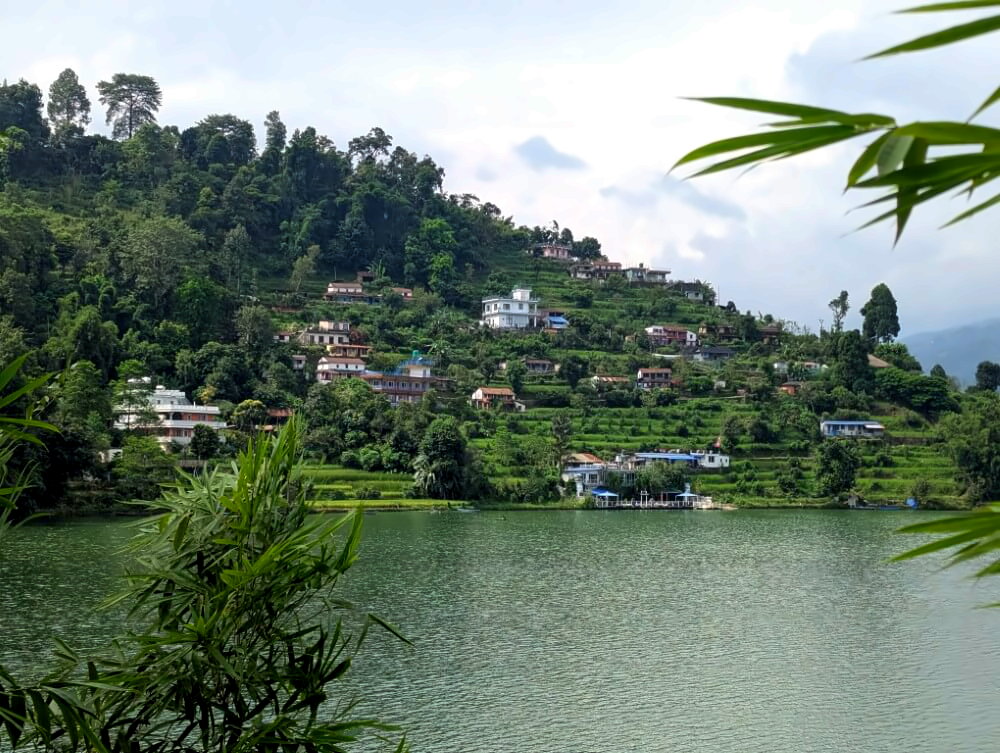
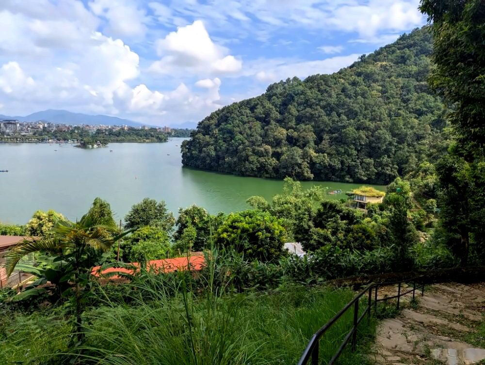
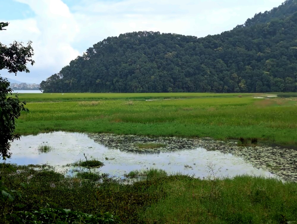
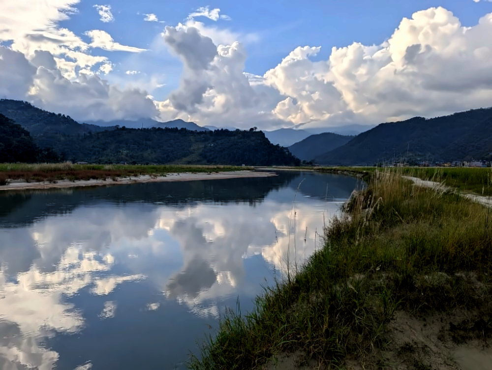
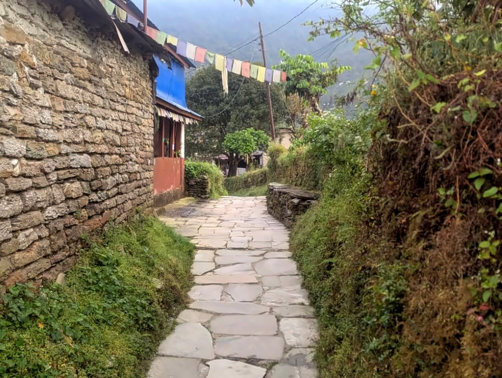
Phewa Lake is Pokhara’s most iconic landmark but there’s more to it than just boating. The entire southern shoreline remains largely undeveloped and that`s exactly the stage of a truly beautiful route – it hugs the lake all the way to the wetlands of the Harpan Valley. The second half of the trail is rarely used, even by locals, making it a bit more adventurous, without ever becoming truly difficult.
Route description
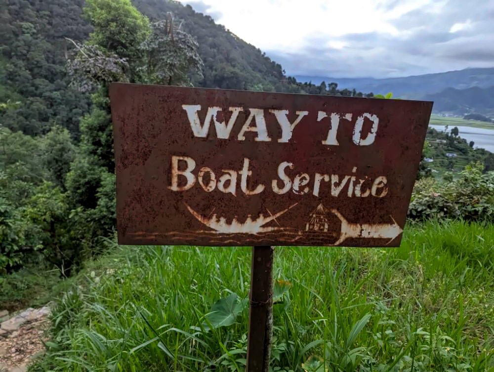
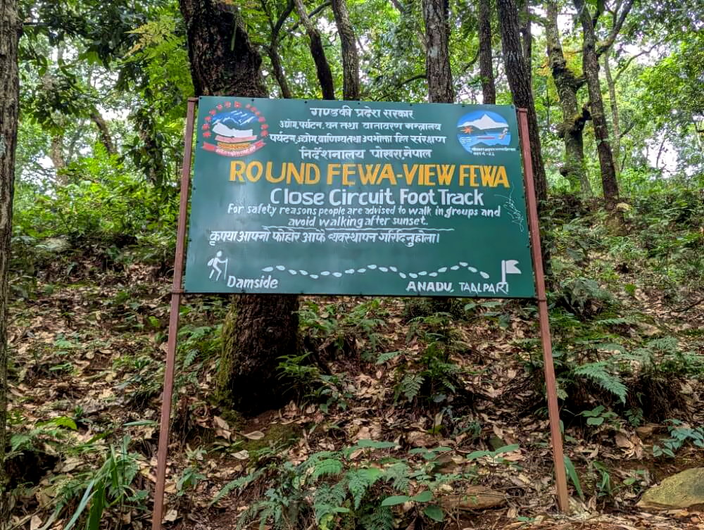
The hike starts in Damside, at the small World Peace Biodiversity Garden. The first section is even signposted as the “Round Phewa” trail and leads past a series of scenic bays through dense sal forests to the boat landing area used for the World Peace Pagoda. This is where the official trail ends and the lesser known part begins.
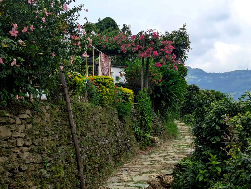
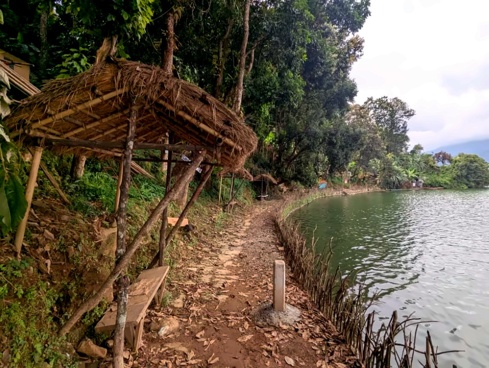
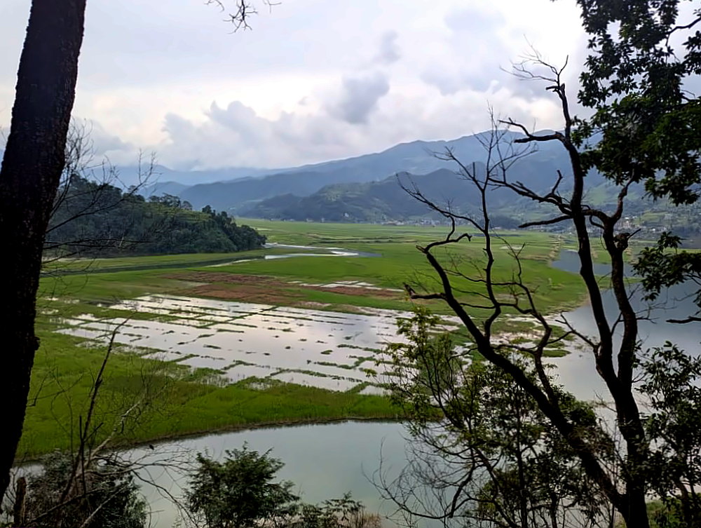
From here, follow a quiet village path that connects the scattered settlements along the southern shore. You’ll pass a small lakeside promenade and a handful of camps and jungle bungalows. It feels like the 1970s never really ended here – part-time hippies will find their perfect escape from the bustle of Lakeside. Beyond the Tapani Gurung Society the path narrows into a slightly overgrown jungle trail but it remains easy to follow. Just before reaching the wetlands, a short section may be flooded – stick close to the shoreline here (check the GPS track if needed).
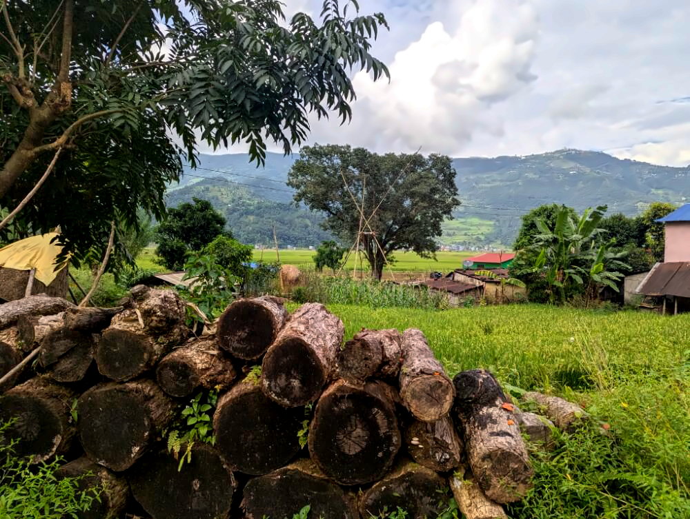
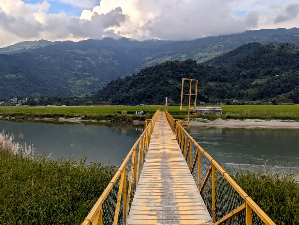
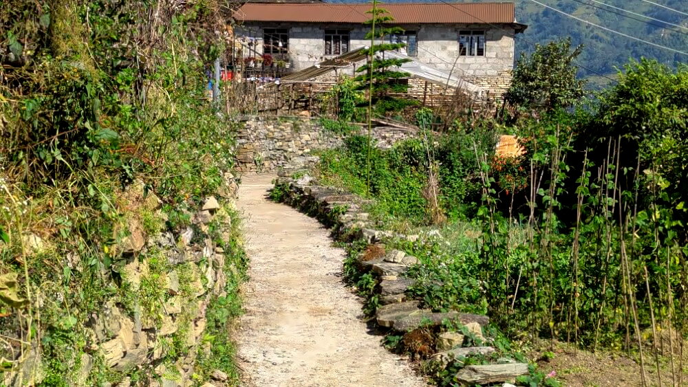
Try to avoid side paths leading to private properties (watch out for guard dogs), but there’s always a clearly visible main trail. In Talpari, you’ll reach a dirt road along the forest edge – follow it to Putalise Village. One village further on, turn left at Pizzeria Ghorka and continue along a beautiful path through rice fields. Finally, cross the well-known Yellow Bridge over the Harpan Khola and reach the road to Pame, where you can catch a bus back to Pokhara.
Photo gallery:
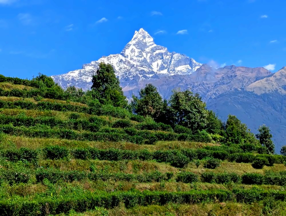
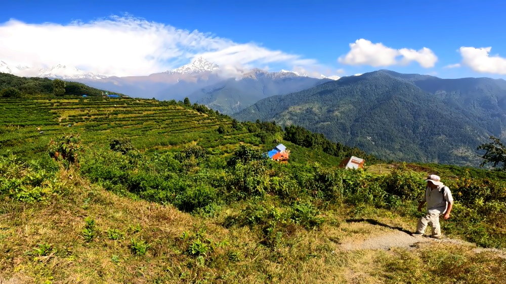
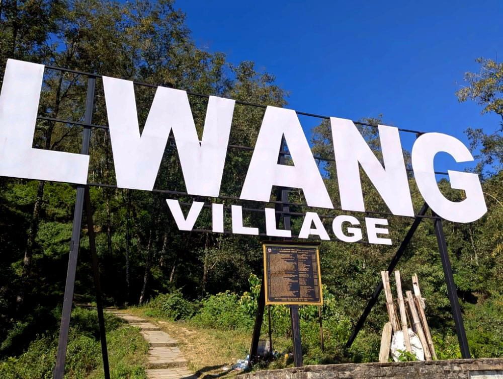
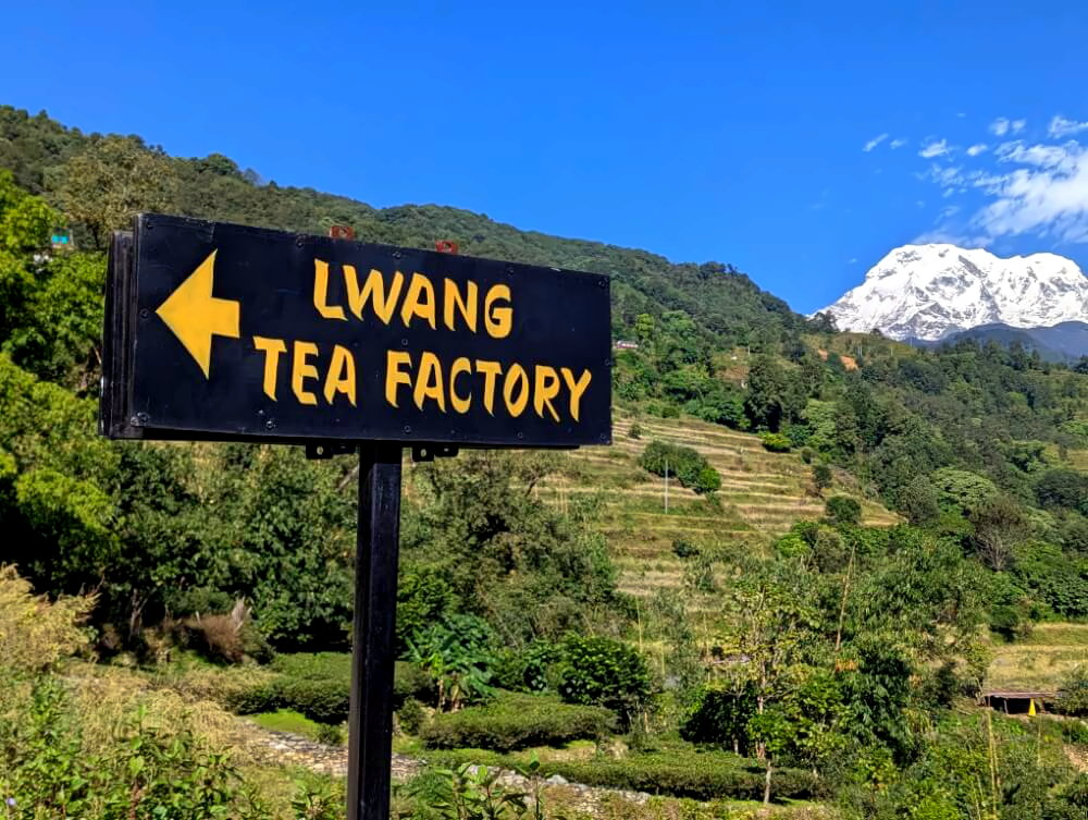
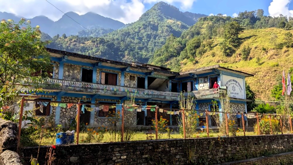
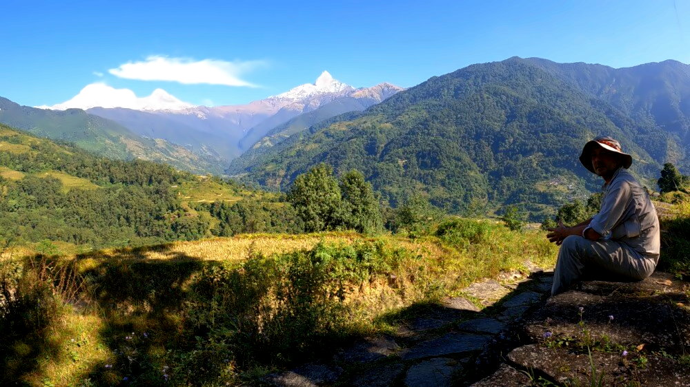
Magical Machapuchare: The Tea Gardens of Lwang
Distance: 9 km · Duration: 6–7 hours · Difficulty: easy to moderate
⛰️ Elevation gain: +865 m / -785 m
🔎 Notes: relatively steep climb to the tea gardens, afterwards easier
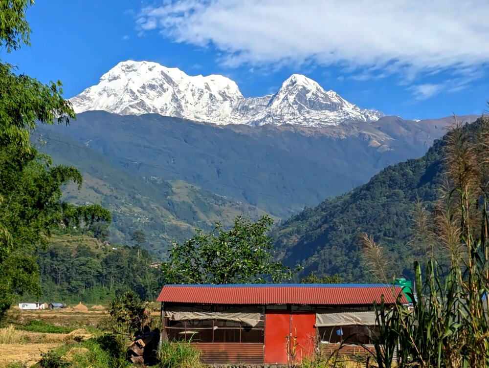
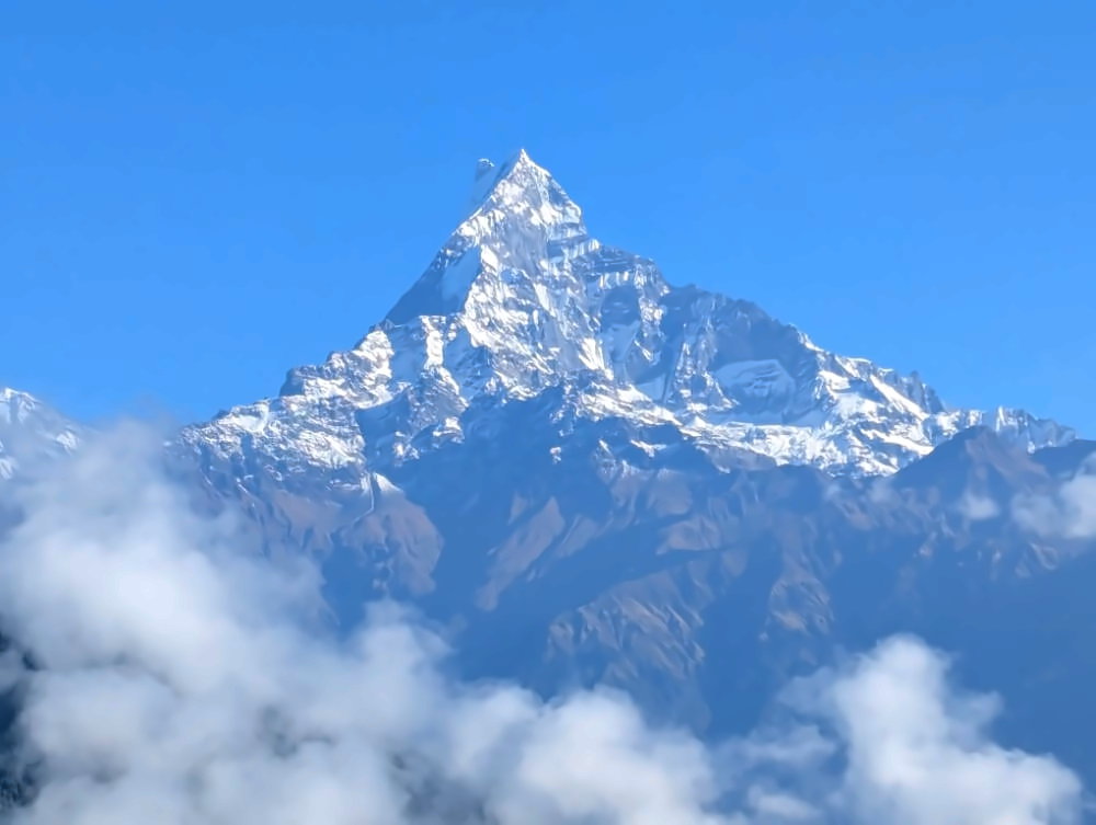
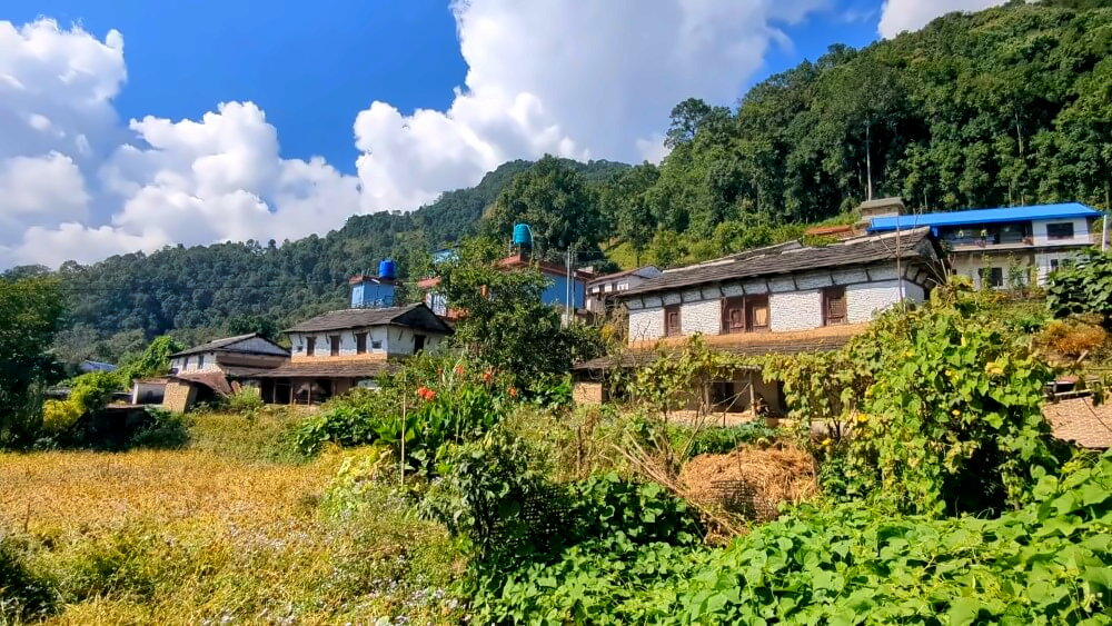
The tea gardens of Lwang are one of the best-kept secrets around Pokhara. Carved into the hillsides some 500 meters above the Mardi Valley, these beautifully terraced fields offer a picture-perfect view of the southern face of Machapuchare – the iconic “Fishtail” peak. The second part of the hike follows an old trail to Lumre, arguably the most charming village in the entire valley. Lwang also serves as an alternative starting point for the Mardi Himal Trek.
Route description
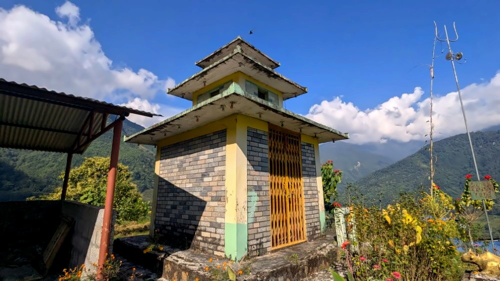
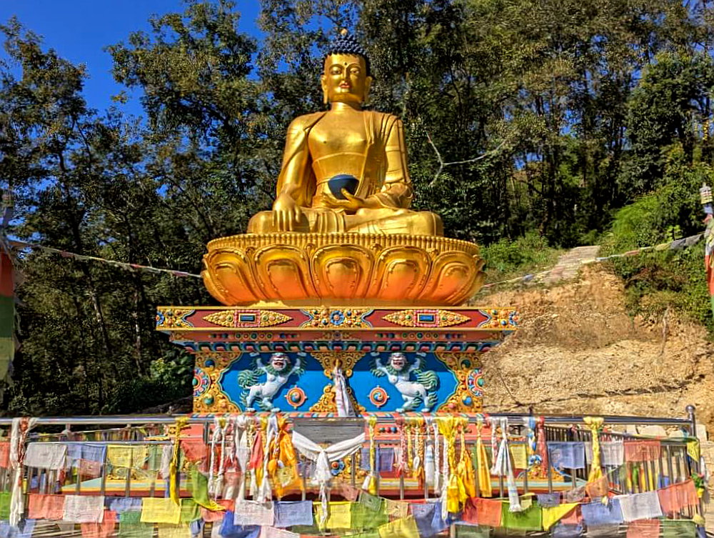
The best starting point is the small village of Khora Muk at the entrance to the Mardi Valley. From here, a well-maintained trail climbs steadily but not too steeply to Lwang in about 40 minutes. Once in the village, follow the signs toward the central information board and continue up a series of stone steps to a distinctive golden Buddha statue. From here, it’s just a few more minutes to reach the tea gardens, which you can explore on a short loop trail.
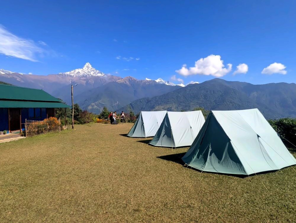
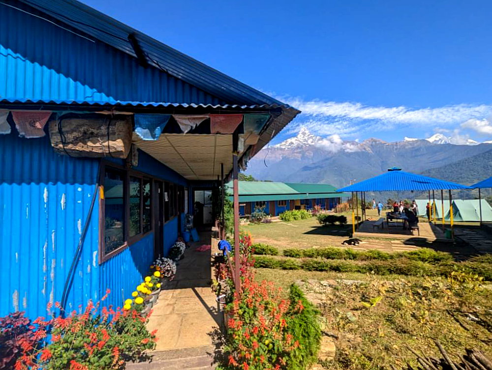
The atmosphere in Lwang is very peaceful. At most, you’ll encounter a few local visitors – often dressed in traditional Gurung attire, posing for photos against the dramatic mountain backdrop. (Yes… Gurung-cosplay is very popular with Nepali girls). If you want to stay overnight, camping is possible at the community homestay in the upper section of the tea gardens. Also, the tea served there is excellent.
After exploring, head back down into the village and continue past the communal washing area to rejoin the trail. The path alternates between forest sections and open stretches along terraced hillsides, eventually leading to the next village, Koleli (home to a very rustic homestay). From here, begin the descent through terraced fields. After about an hour, you’ll reach the picturesque village of Lumre – the last large settlement in the Mardi Valley. Buses back to Pokhara run from here every two hours, with the last departure at 4:00 pm.
Photo gallery:

Annapurna for Beginners: The Dhampus Hill Hike
Distance: 8 km · Duration: approx. 6 hours · Difficulty: easy to moderate
⛰️ Elevation gain: +475 m / -970 m
🔎 Notes: section between Australian Camp and Dhampus partly steep, otherwise easy
Dhampus Hill is a classic daytrip from Pokhara and a perfect introduction to hiking in the Annapurna region. The trail is set in the Annapurna Conservation Area, so you’re rewarded with impressive Himalayan views. The good news: no permit is required for this hike as the ACAP checkpoint lies further north at Pothana. The highlights of this trip are the stunning, little-used ridge between the Australian Camp and Dhampus and the beautiful village trail through the traditional settlement of Phedi.
Route description
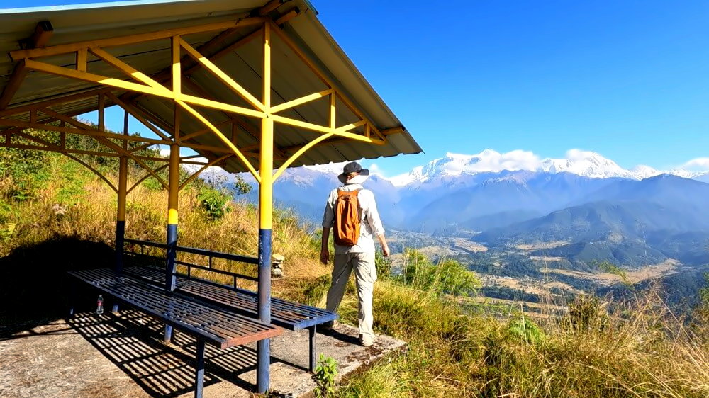
The hike starts in Kande, a common trailhead for several treks, including the Annapurna Base Camp or Mardi Himal route. The first section follows the standard ascent to the Australian Camp – a scenic cluster of lodges with sweeping Annapurna views and several teahouses (for one of the best viewpoints, check out Hotel Gurans). From the camping area near Sunrise Camp Resort, leave the main Mardi route and head onto the ridge leading toward Dhampus.
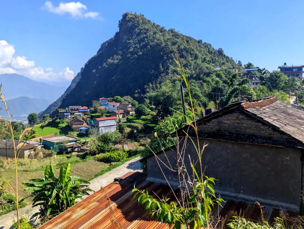
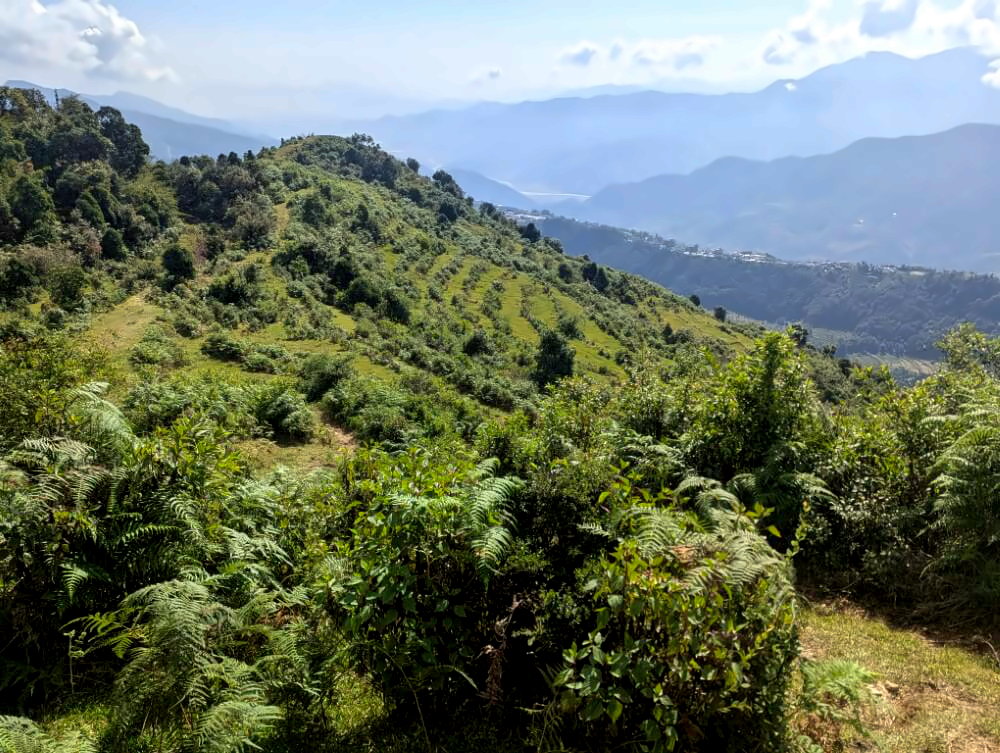
This next section is the highlight of the hike: A rocky natural trail, marked with red ribbons, leads you along a series of viewpoints with outstanding Himalayan vistas. Despite the views, this ridge is surprisingly tourist-free – most guided groups take the less scenic valley route further below. Crossing open grassy slopes, you eventually reach the long ridge where the Gurung village of Dhampus stretches along the hillside.
If you prefer, you can catch a bus back to Pokhara from Dhampus. However, the final section of the hike is well worth it. After a short walk through the village, turn onto a stone staircase heading south. This path leads you down through the beautiful terraced fields of Dhampus Phedi. Accompanied with marvellous views across to the ridge of Sarangkot (from hike #2), you descend to Ghattekhola where buses run regularly back to Pokhara during the day.
Photo gallery:
- ✔ Recorded and field-tested by myself
- ✔ Compatible with major navigation apps
- ✔ Ready to use instantly
How difficult are the hikes?
The hikes featured here are best described as easy to moderate. Most trails follow traditional village paths and natural footpaths used by local communities. Some sections are narrow, but there are no exposed or technically challenging parts.
The trails also don’t reach particularly high elevations – at least by Himalayan standards. All routes stay well below 2,000 meters, so you won’t need prior acclimatization. In fact, they can work as preparation for longer treks like the Annapurna Circuit, Annapurna Base Camp, or Mardi Himal. Overall, these hikes are more about enjoying the landscape and soaking in the atmosphere than pushing physical limits.
💡 Note: In Nepal, many walking routes include steep stone staircases – both uphill and downhill. The hikes presented here are no exception. That said, I’ve deliberately avoided routes with excessively long or punishing stair sections.
How to get to the trailheads
All of these hikes are located in the immediate surroundings of Pokhara and are easy to reach by bus or taxi. Local buses to nearby villages depart from the Baglung Bus Park, while taxis are readily available along the main road in Lakeside. For the starting points of hikes 2 and 3 (Phewa Backside and Naudanda), you could even walk from Lakeside if you feel like it.
What worked best for me: heading out early in the morning and taking a taxi to the starting point, so I had plenty of time for the hike. In the afternoon, I’d simply catch a local bus back from the endpoint – that worked reliably every time. The only place to keep an eye on timing is Lumre, where the last bus back to Pokhara leaves at 4:00 pm.
Can you get tea, snacks, etc. along the way?
Yes – this is Nepal, after all. You’re rarely far from the next teahouse or homestay. On every hike, there’s at least one place where you can stop for food and drinks. The spots are marked in the GPS tracks. That said, I still recommend bringing a small picnic from Pokhara and at least one liter of water, just to stay flexible.
For more useful tips on Pokhara, check out my in-depth guide:

When is the best time to do these hikes?
Autumn – there’s no question about it. In spring, especially from mid-April onward, the air in lower Kaski region tends to be quite hazy, which limits visibility. I did these hikes between November and mid-December and that’s arguably the best time to go. From early November onward, I had clear skies almost every day, with near-perfect views of the mountains.
What should you pack?
You don’t need much for these hikes. The essentials are sturdy shoes, sun protection, and – depending on the weather – a light rain jacket. Bring at least one liter of water and some snacks. It’s also a good idea to carry a fully charged smartphone with offline maps of the area, a small power bank, and a bit of cash. That’s pretty much all you’ll need.
For more ideas and specific gear recommendations suited to Nepal, check out my detailed trekking packing list.
Are the trails marked?
Unlike the well-known trekking routes, the hikes described here are mostly unmarked. You’ll rarely find signposts or clear trail markers like on the classic treks. That said, the paths themselves are usually easy enough to follow – they’re the everyday footpaths used by locals. Still, it’s a good idea to use a navigation app with offline maps and GPS tracks, just to be on the safe side.
Final thoughts
Most people come to Nepal for trekking, myself included. But there’s something to be said for thoroughly exploring a region from a base. You only really get to know a place if you stay for a while – and when the surroundings are as beautiful as they are in Pokhara, that’s even more rewarding.
For me, these hikes were the perfect balance to the bigger treks. There’s less planning, less pressure, just more freedom to explore. And honestly, those were often the moments that stayed with me the most. So if you’re spending time in Pokhara, don’t just stick to the usual spots. Get out there, wander off the beaten track and follow some of the trails that aren’t in every guidebook -you won’t regret it.
Dir gefällt dieser Artikel? Dann unterstütze mich und lade mich zu einem virtuellen Kaffee ein.

Ohne Kaffee komme ich morgens nicht raus und kann keine neue Abenteuer erleben:)
Hinweis: Der Artikel enthält mit Sternchen * markierte Affiliate-Links, die zu Onlinehändlern wie Amazon führen. Wenn du auf einen solchen Link klickst und etwas kaufst, erhalte ich einen geringen Anteil, mit dem ich diesen Blog finanziere. Für dich ist das die beste Art Dankeschön zu sagen, wenn dir der Beitrag gefallen hat. Selbstverständlich entstehen dabei keine zusätzlichen Kosten.
Hast du noch Fragen? Kennst du andere spannende Touren oder Ausflugsziele in Pokhara ? Dann nichts wie ab in die Kommentare! Ich freue mich von dir zu hören!